From Mills to Maritime: Restoring Everett’s Working Waterfront 90 Years Later


Caption: The newly redeveloped Norton Terminal, in the top left of the photo, allows the Port of Everett to double their cargo space and revive this dormant piece of their working waterfront.

Photo Credit: Port of Everett

Decades after pulp and paper mill operations first began on the same spot, the Port of Everett’s Norton Terminal – a new 40-acre marine cargo facility – opened in December 2022 to once again make this piece of Everett’s waterfront a working site. As the first all new cargo terminal on the West Coast since 2009, the Port estimates that terminal will restore almost 1,000 jobs – hundreds of which were lost when the original mill shuttered in 2011 – and help support the nearly 40,000 jobs generated by surrounding seaport operations from the Port and U.S. Naval Station Everett. This restoration success story was over a decade in the making after the mill shut down and left subsurface contamination on-site.

Cleaning Up 90 Years of Pulp and Paper Mill Operations

Caption: Though ownership changed hands throughout the years, this was a steady working mill for over eight decades, up until closure in 2012.

Photo Credit: City of Everett library digital collections

The original mill became operational in the 1920s – milling pulp and creating paper products – and continued active operations until it shut down in 2012. Left on the site were heavy metals and petroleum, including releases from fuel bulk storage facilities that pre-dated the mill. Aspect, working on behalf of the owner, Kimberly Clark, led the Washington State Model Toxics Control Act (MTCA) upland cleanup process. This involved a years-long remedial investigation to understand the extents of soil and groundwater contamination across 55 acres, a feasibility study to assess cleanup options, and three cleanup actions to expedite the overall cleanup and redevelopment. The main remediation culprits at the site were heavy metals and petroleum, including releases from fuel bulk storage facilities that pre-dated the mill.

300,000 Tons of Material and One Cap Later = Terminal is Open for Business

Caption: Over 300,000 tons of material removed to clear the Site for the environmental cap

Photo Credit: Aspect Consulting

The first two interim cleanups excavated and landfilled more than 56,000 tons of contaminated soils, permanently removing the primary sources of contamination to groundwater. Approximately 250,000 tons of crushed concrete and brick generated during mill demolition were also hauled away, clearing the site and removing a major source of alkaline pH to site groundwater. The finishing step was putting a 9-inch-thick asphalt layer across most of the site, which does double duty as an environmental ‘cap’ and a surface sturdy enough for 40-ton cargo containers to sit on. The environmental cap also includes a state-of-the-science stormwater treatment system to protect the adjacent East Waterway.

Six years after demolition of the former mill infrastructure and considerable cleanup work, Kimberly Clark sold the property to the Port of Everett, supporting the Port’s plans of doubling their marine cargo capacity so West Coast container ships can more quickly get import/export goods to market. Congratulations to the Port for reviving this important piece of the Everett waterfront—restoring both jobs for the regional economy and the site environmental conditions to protect human health and habitat.  

Perspectives on Stormwater Design and Climate Change in the Pacific Northwest

During the 2022 NEBC Stormwater Conference, which focused on emerging stormwater practices in the Pacific Northwest, a city engineer asked if the next update for Western Washington’s Hydrology Model (WWHM) will consider global warming factors. Climate change has been a prominent topic of conversation in the stormwater world recently, prompting industry professionals across all levels to ask similar questions in how tools like WWHM will accurately model future conditions so stormwater designs effectively protect water quality, communities, and habitat.

Floodwaters covered Iowa Street in Bellingham after historic rainfall in November 2021. (Image Credit: City of Bellingham)

Stormwater engineers design and size facilities using past hydrologic event models and observations – for example, western Washington uses precipitation records starting in 1948 through water year 2009 to estimate total rainfall and peak events. While this calculation method was suitable in the past, the impact on stormwater runoff due to more recent changes in precipitation and air temperature suggest that drainage infrastructure designed to manage storms based on historical data may be undersized for future storm scenarios.

According to the April 2022 Stormwater University “Climate Change Impacts to Stormwater” webinar led by Clear Creek Solutions, Inc.’s co-founder Doug Beyerlein, engineers should consider the following factors when calculating stormwater runoff in order to effectively design for future climate conditions: (1) expected changes in rainfall intensity, frequency, and duration, and (2) expected changes in evaporation and evapotranspiration. Anticipating future climate conditions at the design phase will help reduce the risk of unmitigated stormwater causing flooding, erosion, and threatening the health of aquatic species and their habitat.

Stormwater in Washington State

Stormwater management is heavily scrutinized in Washington state. The state helped jump-start the nation’s development of municipal stormwater permit programs in the 1990s and continues to be at the forefront of modern stormwater management approaches. The Washington State Department of Ecology (Ecology) issues water quality permits to cities, counties, and the state’s department of transportation (WSDOT) to ensure that stormwater runoff is being regulated and managed. These public agencies are then responsible for making sure that projects comply with permit requirements through the development and enforcement of flow control and stormwater treatment standards. Stormwater experts routinely use hydrologic models (such as WWHM) to help permit applicants and public agencies monitor stormwater conditions and forecast how stormwater will behave in the future.

Current Stormwater Calculation Methods in Washington State

From a stormwater perspective, Washington state is a tale of two lands. Western Washington (defined, regionally, as land west of the crest of the Cascade mountains) gets annual precipitation between 30 and 200 inches per year depending on location. Within this area is the Puget Sound region, home of the state’s densest population and urbanization. It receives a lot of rainfall, thus impacting runoff and stormwater management codes that influence water quality in receiving waters like the Puget Sound. Eastern Washington, the state’s more arid region, receives from less than 10 to 60 inches per year depending on location.

Washington State Annual Precipitation Map. (Image Credit: Washington State Department of Commerce)

Due to the unique climate and rainfall pattern differences between western and eastern Washington, two separate stormwater design manuals were developed for each region outlining different stormwater calculation methods (i.e., continuous simulation (applying to western WA) vs. single-event hydrology (applying to eastern WA)). Analysis of precipitation data and patterns within Washington define these two methods:

Click to Enlarge Summary of Commonly Used Hydrologic Analysis Methods and Software in Washington State

  1. Rainfall in western Washington often occurs over longer (multi-day) time frames and with relatively moderate intensities compared to eastern Washington. To accurately model and compare pre and post development runoff, it is important to account for the influence of preceding storm events and longer durations of continuous precipitation. Therefore, continuous simulation modeling is required for designing flow-based stormwater quality treatment systems and flow control systems in western Washington. Conveyance systems and some erosion and sediment control systems in western Washington can be sized using either continuous or single-event modeling.  

  2. Rainfall in eastern Washington usually occurs in shorter (often under 1 day) time frames and with relatively high intensities (like during a thunderstorm) compared to western Washington. Therefore, single-event modelling is used to size all stormwater quality treatment systems and flow control systems in eastern Washington. Conveyance systems and erosion and sediment control systems in eastern Washington are typically sized using single-event modeling.

Current Challenges to Adding Climate Change Assumptions to Stormwater Design

The design of our current drainage systems is often based on a traditional assumption that storm events are static or unchanging (also referred to, statistically speaking, as ‘stationarity’ where assumptions for future events are based on past data). However, recent studies conducted by the University of Washington Climate Impacts Group (UW CIG) indicate that storms are expected to become more severe with climate change. These projected changes in extreme precipitation in the Pacific Northwest due to a changing climate can be visualized using UW CIG’s online tool, as shown below. The example here shows that a 6-hour-long, 25-year storm event in Seattle will likely increase in intensity by 27 percent by the 2080s relative to the 1990s, assuming a high greenhouse gas scenario.

This tool provides extreme precipitation projections as a function of decade, duration, and frequency.

In order to accurately capture changes in heavy rainfall events, engineers may consider the projected changes in extreme precipitation for single-event modeling. For use in a continuous stormwater simulation like WWHM, engineers may need to incorporate the climate model projections that have been bias-corrected to match the statistics of a particular rain gauge. Click here for hydrologist Jeff Burkey’s presentation about possible impacts to King County’s stormwater design standards from projected increases in storm sizes due to climate change.

What’s Next for Stormwater Prediction Methods in Washington State?

Engineers attempting to design conveyance, treatment, and flow control systems to account for future conditions are currently stuck in a gray area. With climate change, the assumption of stationarity and exclusive reliance on historical observations for estimating future conditions is questionable.

While updates to continuous and single-event modeling techniques can be implemented using UW CIG’s regional climate model projections, software developers and public jurisdictions have limited resources and funding to quickly do so. Therefore, the current pace of change will likely continue to rely on public agencies (like Ecology and King County) to update guidance for stormwater design manuals, evaluate the capacity of their existing infrastructures to focus on locations to prioritize needed upgrades, and find ways to optimize the effects of retrofit facilities to help mitigate climate change impacts to stormwater.

Contact Stormwater Engineer Cleo Pineda to learn more.

A Soil Infiltration Cookbook: How Deep Does Your Water Go?

Street Flooding Due to Failing Infiltration Systems – Yakima, Washington (Source: Aspect Consulting)

The Pacific Northwest recognized early on the negative effects of urbanization on receiving waters and has been a leader in the stormwater management field for decades. This was initially driven by concerns about the impacts of urban runoff on threatened and endangered species in the Puget Sound area, and later reinforced by the National Pollutant Discharge Elimination System (NPDES) permitting program.

More recently, a study led by the University of Washington solved the mystery of why Coho salmon are dying in urban streams before spawning. As many suspected, stormwater runoff is the culprit. It was found that runoff from high traffic areas contains a tire-related chemical that is toxic to Coho.
As the science of stormwater management continues to progress, practitioners must learn about and apply the latest techniques, including the use of stormwater infiltration. While infiltration is not really a new concept, widespread infiltration design is new for some areas and some water quality designers. When infiltration systems fail, the consequences can range from increased pollutant loading and erosion in streams to flooded roads, businesses, and homes. 

Infiltration Design For Cleaner Water and Better Habitat

Many agencies operate stormwater programs under NPDES Municipal Separate Storm Sewer System Permits (MS4 Permits). MS4 Permits require development projects within the permittee’s jurisdiction to include permanent Best Management Practices (BMPs) to reduce stormwater pollution and flow-related problems. Permanent BMPs typically include detention vaults, filters, and bioretention basins.

Over the last decade, MS4 Permits have started requiring the use of infiltration BMPs to mitigate the hydrologic and water quality impacts of development. From a surface water perspective, infiltrated runoff does not cause stream erosion, has no pollutant loading, and helps recharge groundwater.

Using Infiltration to Reduce Hydrologic and Water Quality Impacts (Source: Aspect Consulting)

Lessons Learned from the Track Record of Filtration and Infiltration

Much like the early application of other stormwater BMPs, some designers don’t have a technical background in infiltration. Numerical models, simplifying assumptions, and step-by-step procedures make applying infiltration feasible for generalists, but there are some key issues to consider.

Accurately Estimating Infiltration Rates. The starting point for designing an infiltration BMP is determining the infiltration rate your BMP is expected to have. Allowable methods have changed over the years, with some agencies requiring in-situ infiltration testing for all infiltration BMPs, and some allowing “grain size methods” to estimate rates in certain cases. It’s recommended to only use grain size methods for screening purposes when soils meet all criteria for application of the equation being used.

Reliance on grain size method results can backfire, which is why in-situ infiltration testing must be done to support the design process, with knowledgeable analysis of testing results. The number of infiltration tests should scale with the size, complexity, and soil heterogeneity of the project site. Thoughtful testing and analysis methods can also indicate if groundwater was mounding during the test, and whether a formal mounding analysis is needed.

Once correction (safety) factors are applied, there are generally two ways an infiltration rate is used to help model and design infiltration BMPs: (a) assume the infiltration rate is constant during BMP filling and emptying; or (b) assume the infiltration rate varies (typically linearly) with water depth (pressure head) above the infiltration surface. Knowing how the infiltration BMP will be sized is important when analyzing test data because the resulting constant infiltration rate will not necessarily be the same value as the variable rate.

Extreme plugging/sediment loading to a proprietary stormwater filter (Source: Oregon Department of Transportation, Operation and Maintenance Manual, DFI No.: D00183, 2011)

Plan to Manage Plugging. Infiltration BMPs are susceptible to the same plugging by stormwater sediments and biofouling that stormwater filters are. Stormwater filters plug up and infiltrating into soil is like infiltrating into a filter. Therefore, pre-treatment to remove sediment is necessary to prolong the life of infiltration BMPs.

Plugging of the infiltration surface is the main reason safety factors are used when sizing infiltration BMPs. Stormwater manuals often prescribe safety factors, but the safety factor really should scale based on the soil being infiltrated into.

For instance, when infiltrating slowly into a fine soil with a permeability not much higher than stormwater sediment, reducing the measured rate by a factor of 2-4 is acceptable. But when infiltrating into coarser soil with a permeability much greater than stormwater sediment, a larger safety factor is warranted (some jurisdictions do set a maximum design infiltration rate). The level of treatment for sediment removal prior to infiltration should affect the safety factor too.

Check and Address Groundwater Mounding. Infiltrating runoff sometimes causes groundwater mounding. As mounding increases, it can reduce the infiltration rate, cause seepage problems, and raise regulatory compliance concerns. We recommend monitoring groundwater during infiltration testing to see if it rises in response to the test. If so, the data can be used to help calibrate a mounding model. In cases where mounding is an issue, a formal analysis and modeling (such as USGS’s MODFLOW) of the receptor soil/aquifer combination should be done and infiltration BMP flowrates and spacing fine-tuned to avoid mounding problems.

Increasing Focus on Deep Infiltration to Meet Low Impact Development Goals

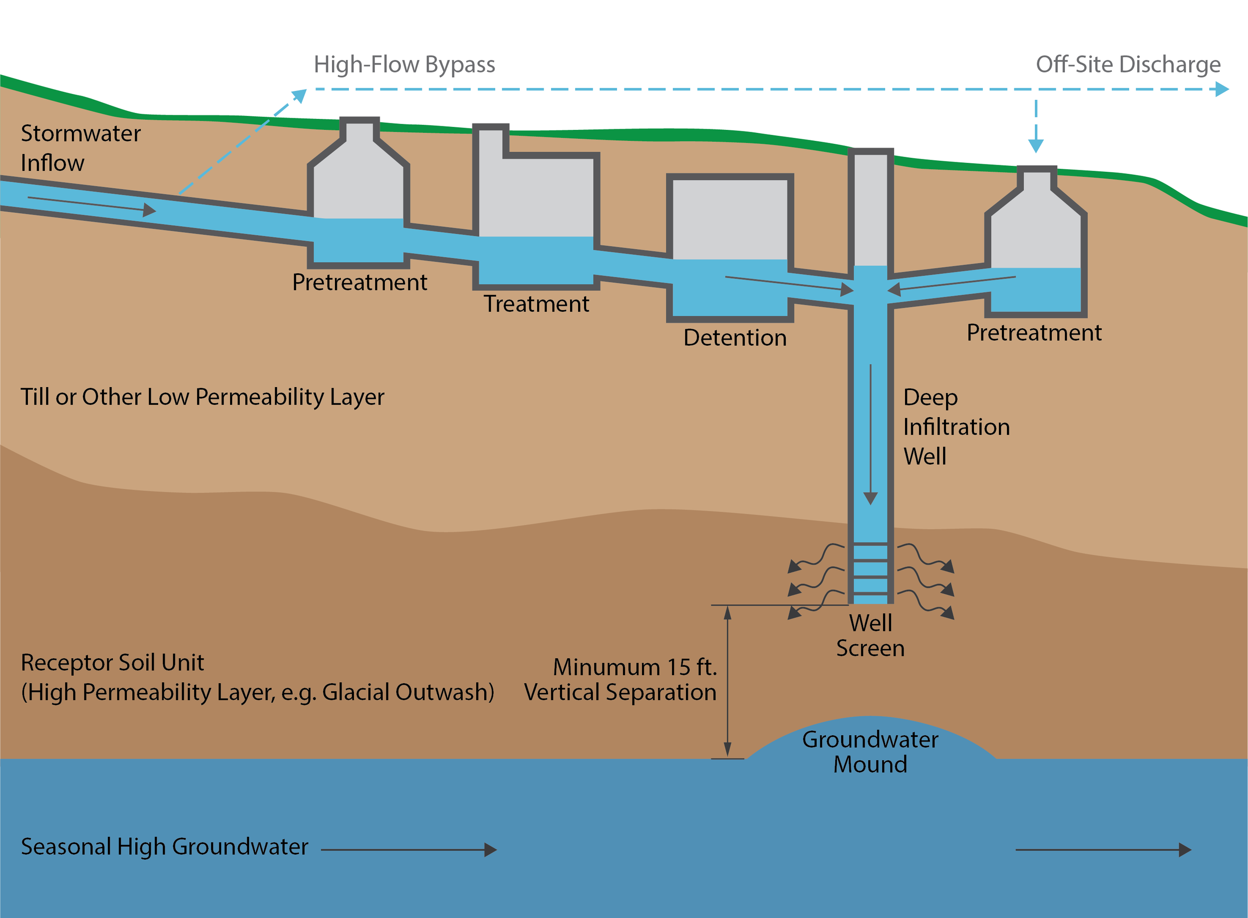
The use of “deep” infiltration to meet project Low Impact Development and flow control requirements has been increasing, particularly where surface soils have low permeability but overlie an unsaturated higher permeability soil. It can be feasible to bore through the surface soil and install an infiltration well in a more permeable receptor soil. Stormwater runoff is routed into the well and infiltrated into the receptor soil.

Simplified Deep Infiltration Schematic (Source: Aspect Consulting)

The concept of deep infiltration is straight forward but a system that reliably functions for decades requires some careful thought. To prevent plugging, it’s critical to keep sediment out of deep infiltration wells. However, normally some runoff is allowed to bypass treatment BMPs during large storms. Directing untreated flow into infiltration wells will reduce their service life. Another consideration is whether advance BMPs can be a source of initial sediment loading including: Is that drain rock really clean? Should I specify on-site washing of drain rock? Will my bioretention mix initially leach sediment? Should I flush the system before connecting to infiltration BMPs?

We recommend designing deep infiltration wells to:

  • Include treatment to remove sediment for
    all flows to the well

  • Control the rate of flow into the well to
    the design rate

  • Reserve head to allow water levels to rise to counteract plugging

  • Prevent baseflows from entering infiltration wells

  • Ensure the system drains down in a
    reasonable time

Using the ‘Infiltration Cookbook’: Infiltration System SOPs

Consistent and successful stormwater infiltration requires clear and comprehensive guidance for planning through construction. As part of the team preparing an updated LID Manual for the Port of Seattle’s Seattle-Tacoma International Airport (STIA), Aspect developed Standard Operating Procedures (SOPs) for shallow and deep infiltration systems. The detailed SOPs for the Port of Seattle— both for shallow and deep infiltration — are publicly available and are a good example of a successful ‘cookbook’ for creating sustainable infiltration design.

SOPs provide guidance for planning, testing, analysis, design, and construction of infiltration facilities. Recommended SOP steps for deep infiltration are shown here:

For more information about soil infiltration best practices for water quality and stormwater issues, contact John Knutson.

An edited version of this article appeared in the February 2022 version of Stormwater Magazine.

The Path to Professional License: James Packman, PMP

In the science and engineering industry, seeing a “PE”, “LG”, “PMP”, or other initials behind someone’s name shows that person went through years of work experience that culminated in a substantial test to confirm the right to practice their area of technical expertise. Many go through this licensing journey but few outside that group know what the process is really like.

We’re telling those stories here. Aspect’s professionals are writing a series of articles that capture the trials and successes of studying for and receiving these career-defining milestones.

James Packman, Project Management Professional (PMP)

Test taken: September 2021

Results given: About 10 seconds after completing the exam (it’s a long and nervous 10 seconds)

James hiking in the Enchantments

Tell us a little about the PMP program. How long does it take?

To qualify to take the PMP exam, one must have 36 months of experience leading projects (60 months if no 4-year college degree) and take a 35-hour prep course. There are many companies that offer PMP prep courses; I chose to take it from Project Management Academy (PMA). The course was live online over 2 weeks. The PMA prep course costs a little more than some other vendors, but they have good online resources, which I used extensively for independent study after the prep course.

After the prep course, I studied for about 4 months before I was ready to take the exam. This was longer than I anticipated partly because I had a challenging personal issue occur (the death of a close friend). I also followed PMA’s advice to keep taking practice exams until you score 80 percent or higher. But in hindsight, I found that the actual exam questions tended to be much simpler than the practice exam questions. Most of the charts, equations, and management models covered in the prep materials weren’t on my exam. Maybe this helped prepare me well, but I think I ended up over-studying.

What was the best piece of advice you got as you started the certification?

Study at least a little bit several days a week. There’s so much information to learn, it helps to build the knowledge in small pieces and reinforce it with frequent study.

What should a person gearing up to do this know about the mental, physical, and social challenges of certification?

For fellow Aspect staff who are considering PMP certification, they should know that only some of the content applies to the types of projects we do at Aspect. Skills like communication, budget management, and leadership apply to every project. But many of the technical project management skills covered in the PMP material are used more widely in other industries, such as manufacturing, software development, and construction.

In some of those other industries, Agile and related approaches, such as Lean, are widely used for managing projects. These methodologies complete work incrementally and/or iteratively from a backlog that is developed during the project. Most of the projects we do at Aspect are what are known as Predictive or Waterfall in the project management world: we scope out the entire project at the beginning and then implement it based upon an agreed budget (here’s a handy article that compares the Agile and Waterfall methodologies).

I find that the project management approach is largely dictated by our clients who often require a complete scope and cost estimate to authorize work. However, an Agile approach could be useful on some Aspect projects, especially when there are unknowns that the initial work will reveal and affect subsequent work. The incremental approach does occur at Aspect to a degree, such as environmental site assessments (Phase II ESAs occurring based on Phase I findings), and I’m using it on some data analysis tasks in the Ecology SAM Study on Stormwater Source Control that I’m leading.

A helpful, albeit intangible, take away for me was trying to adopt an Agile mindset when it makes sense for a project. Specifically, when the work lends itself to adaptive outcomes, flexibility, and the client is open to realizing project value along the way rather than just when the final report is delivered.

Anyone considering PMP certification should also know that the knowledge base is jargon-heavy (at times even pedantic), and a term in the project management world might mean something different in other realms. Sample alternate definitions in the PMP world include the terms: activity, process, risk, charter, coach, domain, quality, parametric, baseline, float, scope, and value—to name a few.

Walk us through the Big Test Day…

I registered to take the exam about a month in advance to get the date and time I wanted. The test is typically proctored at a testing center, though at-home testing was possible during the pandemic. The at-home testing was more restrictive with things like fewer breaks allowed and more complicated with verifying your home setup before the exam. So, I chose a testing center in Northgate (Seattle) that offered evening times so I didn’t have to miss work.

The testing area had about a dozen walled cubicles, each with a desktop computer. You can’t bring anything of your own into the test area: no food or drink, no pen or pencil, not even your own earplugs (they provide). You may take breaks to eat or drink in the lobby but the exam clock does not stop during breaks. The exam is closed-book and they give you a notepad to make notes during the exam, which you must turn in at the end. I was given a few 8x14 laminated sheets and some dry erase markers.

For the exam, you have up to 230 minutes to answer 180 questions, including breaks (the clock keeps ticking!). However, the exam is divided into three segments of 60 questions each, and you have to close out each segment before moving onto the next one. The goal is to answer each question as there is no advantage to leaving questions blank (blank = wrong). So, the exam is effectively three 60-question exams back-to-back and thus requires good time management.

Another good piece of advice I was given is to do a brain dump onto the notes pages as soon as you start the exam. For me, the brain dump was formulas, definitions, and reminders about how to estimate activity durations, calculate earned value, budget forecasting, and the differences among the many types of charts and their associated uses.

How did you feel when you got the results?

Big relief! As soon as you complete the last 60-question segment, there is a pregnant pause, and a moment later it reveals your result. The exam is pass/fail only and you don’t get a numeric score or know which questions you got right or wrong. The result given just as below target, on target, or above target. I was grateful to pass on my first attempt with an “above target” score in all domain areas!

What advice do you have for people looking to get their PMP?

My advice is to give yourself enough time to study (weeks or months depending on your schedule) and for the 35-hour prep course, which is given over 1 or more weeks depending on how it’s taught. Also, be open to learning the concepts as the project management world understands them, some of which may be different than you’ve experienced so far as a project manager.

Putting Data to Work: Kubota Garden Stormwater Story Map

Mud and sand carried by stormwater is washing into the catch basins and through the ponds at the beautiful Kubota Garden in south Seattle. Learn about how a savvy team including a mapmaker, field staff, water quality expert, engineer, and landscape architect put data to use to determine the sources of sediment and craft a plan to restore the garden to the delight of its visitors.

Click to learn how Aspect used Esri StoryMaps to help guide the Kubota Garden Foundation and the City of Seattle (SPU, Seattle Parks and Rec, and SDOT) through the decision-making process.

The Future of Stormwater Management: MuniCon April 5-8 2021 - Part 2

Aspect is looking forward to discussing key stormwater management issues at this year’s Municipal Stormwater Conference April 5-8, 2021. Please join us in four (virtual) sessions where our stormwater team helps lead the discussion of the future of stormwater management in the Pacific Northwest. Please join us for Aspect presentations three and four (the first two Aspect presentations are summarized here)

 Stormwater Infiltration at Seattle-Tacoma International Airport – April 6

Protecting water quality is a key goal for SeaTac Airport’s stormwater program.

Protecting water quality is a key goal for SeaTac Airport’s stormwater program.

Join Tom Atkins, Principal Engineer, for a discussion on SeaTac Airport’s stormwater infiltration program that extends across 1,600 acres  of drainage area flowing into the Puget Sound and three local streams. The Port of Seattle –the steward for SeaTac Airport -- is interested in stormwater infiltration at STIA to achieve NPDES permit LID and flow control requirements along with GSI sustainability goals. Over the past four years infiltration has been investigated through shallow and deep infiltration feasibility assessments to guide the testing, analysis and design of BMPs for future development. This presentation will summarize the challenges, outcomes and tools that this work has produced, and will describe the deep infiltration testing planned for 2021.

How Shoreline Is Integrating ‘Salmon-Safe’ and the NPDES Phase II Permit – April 7 

In 2019, the City of Shoreline was the first in the state to achieve Salmon-Safe certification.

In 2019, the City of Shoreline was the first in the state to achieve Salmon-Safe certification.

Join Bryan Berkompas, Associate Hydrologist, to learn how Shoreline became the first city in Washington to achieve Salmon-Safe certification and how they are incorporating its requirements in City operations. Salmon-Safe guidelines are rigorous but also complimentary with many of the requirements of the NPDES Phase II permit. This presentation will discuss the process of achieving Salmon-Safe certification, the benefits of Salmon-Safe certification, and designing programs that satisfy the requirements of both the Permit and Salmon-Safe.

Join Aspect Stormwater Experts (Virtually) at NEBC Stormwater Conference Thursday September 10

Touted as “The State’s Largest and Most Comprehensive Stormwater Conference,” the Northwest Environmental Business Council (NEBC) will host the Managing Stormwater in Washington state conference on Thursday, September 10th. For the first time, this conference will be held virtually, and Aspect is proud to be a premier sponsor of the event again.

This focused one-day conference is Washington’s leading stormwater event, convening regulated companies, governments, solution providers, and regulators for learning, networking, and business development. The conference’s educational sessions will cover both fundamental and advanced topics in the areas of industrial, construction, and municipal stormwater management. Aspect’s stormwater professionals Owen Reese, James Packman, John Knutson, and Erik Pruneda and will also be contributing to three of the sessions.

Owen will be part of the panel during the conference’s Featured Plenary Session, The Impact of Third-Party Lawsuits. Clean Water Act lawsuits brought by public interest groups have become an effective enforcement tool for stormwater permit compliance. Functioning as a supplement to agency enforcement efforts and feared by regulated industry, these citizen suits can lead to unwanted scrutiny and often carry stiffer penalties than an agency enforcement action. The panel of experts will shed light on the citizen suit provision of the Clean Water Act, causes and timing, and what you can expect if you find yourself in trouble.

James will moderate the Municipal Fundamentals session, where attendees can gain a thorough understanding of the basic elements of municipal stormwater management including general permit requirements and enforcement; watershed planning; source control; creating Stormwater Pollution Prevention Plans (SWPPPs); proper sampling techniques; and the most common Best Management Practices (BMPs) in municipal settings.

John and Erik will be presenting on the Keys to Successful Infiltration, where they will discuss the recently published Infiltration Standard Operating Procedures (SOPs) that Aspect developed for the Port of Seattle’s Seattle-Tacoma International Airport. The SOPs provide a holistic process for planning infiltration system and dive into the details on field testing and using test information to support design.

Learn more about the conference HERE.

Key U.S. Supreme Court Decision on Groundwater and the Clean Water Act

Groundwater flow path from the County of Maui’s Wastewater Reclamation Facility to the Pacific Ocean. This facility is the subject of the U.S. Supreme Court case. An extensive hydrogeologic study was completed to map how pollutants travel through groundwater to the Ocean. Source: Lahaina Groundwater Tracer Study

On Thursday, April 23, the U.S. Supreme Court ruled in County of Maui v. Hawaii Wildlife Fund, setting an important, but difficult to implement, precedent for determining when National Pollutant Discharge Elimination System (NPDES)[1] permits are required for discharges to groundwater.

How this Case Came to Be

The County of Maui discharges treated municipal wastewater to the ground through four wells about a half-mile from the Pacific Ocean. Multiple environmental groups sued under the Clean Water Act, alleging that the discharge required an NPDES permit.

The U.S. District Court agreed with the environmental groups, concluding that a permit was required because the discharge was “functionally one into navigable water.” The Ninth Circuit Court affirmed, establishing a test that permits are required when “pollutants are fairly traceable from the point source to a navigable water.”

The County appealed to the U.S. Supreme Court. EPA weighed in, offering an Interpretive Statement that concluded that all releases of pollutants to groundwater are excluded from the Clean Water Act’s permitting program, “regardless of a hydrologic connection between the groundwater and a jurisdictional surface water”.

The Supreme Court set aside the prior approaches by the District Court and Ninth Circuit, and did not give deference to EPA’s opinion, instead crafting their own solution that NPDES permits apply “to a discharge (from a point source) of pollutants that reach navigable water after traveling through groundwater if that discharge is the functional equivalent of a direct discharge from the point source into navigable waters.”

In a recent blog post, attorneys from Stoel Rives view the Court’s decision as taking the middle ground, resulting in the need for potentially difficult case-by-case evaluations based on the non-exclusive list of seven factors the Court defined as important for functional equivalence:

  1. Transit time

  2. Distance traveled

  3. The nature of the material through which the pollutant travels

  4. The extent to which the pollutant is diluted or chemically changed as it travels

  5. The amount of pollutant entering the navigable waters relative to the amount of the pollutant that leaves the point sources

  6. The manner by or area in which the pollutant enters the navigable waters,

  7. The degree to which the pollution (at that point) has maintained its specific identity

Hydrogeologic Science to Increase in Relevance

The opinion established time and distance as the most important factors in most, but not all, cases.

This emphasis will likely prove problematic, because time and distance, while important, are often not enough, by themselves, to resolve the question of whether pollutants are being transported to a surface water. Should it matter how close (in time or distance) a discharge is to a surface water, if the subsurface conditions provide adequate treatment? In many cases, the other factors identified by the court may prove more important. These questions will likely only be resolved through hydrogeologic studies, and in many cases litigation, at the expense of the individual dischargers.

Implications for Pacific Northwest Businesses and Municipalities

This decision has relevance to businesses and municipalities in the Pacific Northwest that discharge stormwater or wastewater to ground. We expect to see increased attention from regulatory agencies and environmental groups focused on discharges to groundwater. In particular, facilities that are currently exempt from the Industrial Stormwater General Permit because they only discharge to ground should carefully examine their discharge relative to this decision.

To learn more and discuss the relevance of this case further, contact Senior Associate Water Resources Engineer Owen Reese at oreese@aspectconsulting.com or 206-838-5844.

[1] NPDES is the federal program that regulates the discharge of pollutants to waters of the United States.

Meet Cleo Pineda and Baxter Call

Aspect recently welcomed Cleo Pineda and Baxter Call to our Seattle office. Here are Five Questions we asked to get to know them better…

Cleo Pineda, Stormwater Engineer, EIT

“I rode in a crystal cabin up to the Yao Yue Tea House in Taipei, Taiwan. The floor to ceiling windows provided scenic views of lush green mountains and tall skyscrapers as we approached Maokong mountain…2.5 miles all the way to the top”

1. Where are you from? If you’re not from the Pacific Northwest, what brought you here?

I was born in Pampanga, a province located on the largest island of the Philippines. After my grandpa retired from the Navy and received his U.S. citizenship, he settled down in Lacey, Washington, and petitioned for my family and I to come to America. In June of 2000, I flew to the PNW with my two older sisters and our dad. The immigration process for my mom and younger brother took longer than anticipated so they didn’t get to join us until six years later. During the time we were apart, I traveled back to the Philippines to visit them for extended periods of time. I haven’t been back to the Motherland since 2006, but I heard a lot has changed since my last visit and I’d love to go back there someday.

2. What inspired you to pursue stormwater engineering? What made you curious about it?

The deeper I got into my civil engineering major, the more I realized how much it is a service-driven profession as it is a technical profession. I took stormwater design as an elective during my junior year of college, and it was in that class where I first saw the connection between my personal strengths and their impact on serving a “real-world” purpose. Like many engineers, I went into this career to help solve problems—and protecting the health of our waterways was a goal that made the most sense to me.

3. What do you like best about your area of expertise? What excites you and keeps you motivated?

Every project will get rained on, especially here in the PNW. What’s cool about stormwater design is that each site will have its own unique set of solutions. The design process involves factoring in not only varying site conditions but also the far-reaching implications of stormwater pollution that inspire me to use inventive ways of implementing on-site stormwater management. The days of solely relying on traditional conveyance systems are over. Stormwater design keeps my mind open to new ideas, which is what I love most about engineering in general.

4. What do you like to do when you aren’t working?

Though I enjoy the “structure” involved in engineering (no pun intended), I make it a point to exercise the right side of my brain too whenever I get the chance. I was raised in a very creative household. My dad showed all my siblings and me how to play instruments, while my mom taught me how to cook Filipino dishes. Some form of art was always happening around me growing up. Now as an adult, I spend most of my free time painting, writing, trying new recipes, or building DIY home improvement projects. During the summer, I take advantage of the nice weather by going on new hikes and city day trips with my loved ones.

5. Anything else you’d like us to know about you?

Experiencing different cultures is one my life’s greatest pleasures. Last year, I got to explore different parts of Asia (Tokyo and Taipei). This year, I will be going to Europe for the first time. I’m excited to visit Paris with my boyfriend and family in October.

Baxter Call, EIT, Environmental Engineer

1. Where are you from? If you’re not from the Pacific Northwest, what brought you here?

I was born in Seattle and grew up living on Vashon Island. Being a kid on a small island, I feel like I had the quintessential PNW experience; sea kayaking and biking in the summers and skiing on the weekends in the winter were certainly the highlights! That love of the outdoors has kept me firmly planted in the PNW—I only got as far as the Willamette Valley in Oregon for any significant amount of time before moving back to Seattle. Corvallis, where I completed my undergraduate degree, feels a lot like Vashon in that it is content to exist a little removed from the hustle and bustle of city life. Living in Seattle has been a great new experience and offers a lot more variety than I am used to, although I have discovered that I have no patience for sitting in traffic and try to avoid it at every opportunity.

2. What inspired you to pursue environmental engineering? What made you curious about it?

I have to thank my parents for introducing the idea of environmentalism to me. They framed it as an effort to protect the things that we derive such enjoyment from and are so easy to take for granted. That idea has stuck with me and is certainly why I chose Environmental Engineering without hesitation when I started college, and I haven’t looked back since. My interest started to focus when I began taking more classes related to chemical fate and transport in the environment. I think that there is a really engaging problem-solving challenge to environmental engineering work, and that has always held my attention.

3. What do you like best about your area of expertise? What excites you and keeps you motivated?

Something I find very exciting about my area of expertise is the long-time scale that we work on. Environmental processes are slow, even considering all we do to accelerate them. While that does not sound conventionally exciting, it forces you to take a step back and consider the big picture. When you adopt that way of thinking the anxiety of day-to-day, minutia disappears and what you are left with is a body of work that you can be proud of. I really connect with that idea and it helps me work come to work every day with a purpose.

4. What do you like to do when you aren’t working?

Rowing has been a huge part of my life since I was 14 years old and continues to be something that I derive an immense amount of pleasure from. As I have gotten older, and the injuries have piled up, I have shifted my focus away from competing and towards coaching. Most weekday evenings and early weekend mornings you can find me barking at the Green Lake Crew high school guys team. I also enjoy running and biking, which have been a great way to familiarize myself with the city.  

5. Where in the world would you like to travel next?

I have not traveled nearly as much as I should, so I have a lot of ground to make up in this category. Madagascar is a destination that is on my radar right now. One of my best friends is in the middle of a Peace Corps deployment in Madagascar. The country sounds very interesting, and the opportunity to go and visit him makes it easy to justify traveling there when normally Madagascar might be forgotten with so many other cool places to visit.

The Rainy Season Part 1: When Geohazard and Stormwater Specialists Shine

The end of 2019 and the first months of 2020 brought unprecedented rainfall across the Pacific Northwest—as just two examples, January was the third wettest Seattle month ever; areas in Northeast Oregon received 10 inches of rain in 3 days. This even-rainier-than-usual season has inundated the region with flooding and landslides. These events are a threat to the safety of homes, businesses, and infrastructure. In this two-part series, we’re highlighting how Aspect professionals have been helping assess earth and water challenges caused by the rain and help communities and clients problem-solve.

Our first part of the series looks at some of the scientific tools we use to track hazardous conditions during wet weather and how we respond to help local communities assess and repair damage from earth movement.

Landslides: When Water and Steep Slopes Don’t Mix

Landslides lie dormant and unseen to the untrained eye for years, and even decades. However, intense short-term or persistent long-term rainfall can waterlog steep slopes and awaken landslides triggering widespread damage. In February 2020, following a period of heavy precipitation, a landslide six miles south of Bellingham shut down half of Washington State’s main business artery – Interstate 5 – for half a day. 

Location of landslide across Interstate 5 south of Bellingham in February 2020

Photo Credit: Whatcom County Weather

One Tool to Understand Landslide Risk: Cumulative Precipitation Threshold 

Among other monitoring approaches, Aspect’s geohazard team uses a public tool created by the United States Geological Survey (USGS) to help continuously assess the level of landslide risk in the Puget Sound region.

This tool was developed after reviewing data on historical conditions from 1933 through 1997, including several notable intense rain events that triggered multiple landslides in the Puget Sound area—notably those in 1986 and 1997, which are two of the biggest landslide “years” in Seattle history because of the amount of rainfall (and for 1997, the rain fell on top of snow during the winter, creating significant soil saturation conditions).

The tool uses monitoring points near Puget Sound coastal bluffs to give a snapshot of rainfall intensity and duration in the area. From these data, the USGS developed “rainfall thresholds” to forecast landslide potential and risk along rail corridors between SeaTac and Everett.

From this data, the USGS developed an intensity (I) and duration (D) relationship (shown above).

For example, on the left side, the graph shows that 1/10th (0.1) of an inch of rain per hour, falling steadily for about 22 hours, is enough to enter the high-risk threshold (yellow area over the blue line). Similarly, about 1/20th (0.05) of an inch per hour falling over 45 hours will enter the threshold. This means short-intense rain AND less intense, but long-duration rainfall can both oversaturate the ground and cause a landslide.

How Wet Has Winter 2020 Been in the Pacific Northwest?

Thanks to recent data from the USGS’ Mukilteo monitoring station, Winter 2020 in the Seattle area has been a season of unrelenting precipitation. We’ve had two different periods where the Seattle area has been over the cumulative landslide threshold for two straight weeks.

This is a snapshot of Jan 29, 2020, landslide threshold graph. Any symbols to the right of (or above) the red line indicates heightened landslide risk. Taking about a 2-month period, from Dec 1, 2019 – Feb 11, 2020, the Seattle area has been to the right of the line twice for significant, extended periods of time (for about two weeks straight each time—Dec 20, 2019, through about January 7, 2020, and from January 28, 2020, through Feb 11, 2020.) Special thanks to Rex Baum of the USGS for the recent Seattle-area 2020 data.

That is a substantial amount of time for soils to stay wet because, well, water is heavy. And when water saturates soil over longer-than-normal periods it adds enough weight that can cause the soil to move on steep slopes. Think about the difference between a box of feathers on a sloped bed of marbles versus a box of wet feathers on that same sloped bed of marbles. The heavier that box becomes it starts to move. Here are some additional technical factors involved in this kind of landslide:

  • A buildup of groundwater can pressurize the soil’s pore spaces, which reduces the strength of the soils causing the soils to fracture or slide.

  • Trees and their root structures can greatly reinforce shallow soils, but they have less ability to hold onto soils that have lost strength due to saturation, leading to loss of strength in the soil reinforced layer and toppling of shallow, rooted trees.

Responding to Geohazards

When active landslide hazard potential rises, Aspect’s geologists and geotechnical engineers prepare to support local agencies with whom we have on-call contracts. These contacts often include specific language that Aspect be ready to support public works staff as they respond to sudden or emergency geohazard events. During this last round of heavy precipitation, we were spurred to action with a call from the City of Kenmore—we provide geotechnical services as part of their team for an on-call contract—about a landslide impacting a roadway. We were on site to assess conditions within about one hour.

Result of a shallow surface landslide in Kenmore, which closed part of a road in the City.

Another view of the slide that resulted from heavy rains, which Aspect responded to within an hour.

The City wanted Aspect to assess potential risks. Are the residences atop the slope safe from further movement? How will removing the weight of the slide debris affect the slide? Our assessment concluded the slide posed a low risk to the residences and we were able to assure the City that removing the debris would not create further concerns for the slope.

Stay tuned for Part 2 of our Rainy Season series – where we learn how stormwater and water quality experts “storm chase” to track storms and perform water monitoring in wet conditions.

Aspect's Erik Pruneda Speaks on Floodplain Mapping at December 3rd Law Seminar

On December 3, Aspect’s Erik Pruneda, PE, CFM will be presenting on floodplain mapping changes due to climate change at The Seminar Group’s 18th Annual CLE Bootcamp in Seattle. His talk will focus on the impacts of climate change on coastal and riverine flooding and how flood hazards are being represented in the National Flood Insurance Program (NFIP) Floodplain Insurance Rate Maps (FIRM).

James Packman Presents on Urban Environmental Planning to University of Washington Class

Aspect’s James Packman presenting on environmental planning as a profession to University of Washington students

Aspect Senior Hydrologist James Packman presented on environmental planning for the second year to a class in the College of the Built Environment at the University of Washington.

The students in the “Planning as a Profession” class learn about urban planning from a different guest lecturer each week who is a professional working in their field. James presented environmental planning from a holistic point of view—from the skills and interests that lead a person to the profession and the different disciplines working in the industry to the laws and regulations that drive project design, permitting, and building and examples of water-focused planning. His overarching message focused on interdisciplinary skills, and he gave examples of Aspect projects where collaboration between disciplines was vital to both win the work in a competitive consultant market and address the environmental elements.

One example of an urban planning project is Seattle’s SEA Streets Project, which changed several streetscapes in residential neighborhoods to decrease stormwater runoff.

For example, James discussed how planning and executing urban stormwater management projects – such as the City of Seattle’s innovative SEA Streets program in north Seattle – have many benefits: reducing stormwater runoff before it reaches the sewer and downstream water quality; improving habitat diversity; narrowing streets that make cars slower and increase safety, and increase street aesthetics and property values.

For the homework and in-class activity, James introduced the State Environmental Policy Act (SEPA). In small groups and guided discussion, the students learned about the many environmental planning elements required to complete a SEPA checklist. Through this exercise, they developed a list of skills and areas of knowledge required for each SEPA topic, which will be a valuable reference as they transition into their careers and work in urban planning.

Attracting Talent – Simple Steps, Great Results

Lindsay Pearsall - Director of Human Resources

Earth science and engineering firms are in a buyer’s market in 2019. Anyone in a leadership position in the Architectural/ Engineering/ Construction industry knows the mantra of “Always Be Recruiting.” At Aspect, we are no different. Our success (and our clients’) hinges on our ability to find and retain the most talented consultants in our industry. It’s essential, then, that our Human Resources department takes a very thoughtful approach to finding and hiring this top-tier talent.

Recently, at RecruitMAX 2019 – one of the A/E/C industry’s top professional industry conferences—Aspect’s HR Director Lindsay Pearsall shared a segment of her approach with a presentation “How to Build a REAL Candidate Pipeline with Phone Interviews and Informational Interviews.”

Some takeaways of Lindsay’s presentation are:

  • Why treating your candidate like a client should be your #1 priority

  • Conducting informational interviews to go beyond your current hiring needs

  • Simple solutions, like how and when to follow up with individuals, to maintain relationships

Lindsay’s presentation stressed that hiring managers need to remember how difficult it is to be a candidate. By flipping the script and treating candidates like a client, we are able to humanize the experience. Whether someone is hired or not, they should have an expectation of a positive experience and feel valued as a professional and as a human.

See current job openings for Aspect here: https://www.aspectconsulting.com/careers

A Peek Inside Washington State's Draft Industrial Stormwater General Permit

Stormwater discharges from over 1,200 industrial facilities are covered under Washington’s Industrial Stormwater General Permit (ISGP). The goal of the ISGP is to reduce the discharge of pollutants by improving management of stormwater at industrial sites. It originates from a combination of federal (the Clean Water Act) and Washington state (Water Pollution Control Act) law. Under the ISGP, permittees are required to implement Best Management Practices to reduce stormwater pollution, monitor their stormwater discharges, compare the results with benchmark values, and implement an escalating series of corrective actions depending on the number of times the benchmarks are exceeded. The current permit has brought compliance challenges, including expensive stormwater treatment systems and citizen law suits, to many permittees.

On May 1, 2019, the Washington State Department of Ecology (Ecology) published a draft of the next ISGP for public comment. Owen Reese, PE, Aspect’s stormwater practice lead, offers this synopsis:

What Won’t Change

Many of the key permit provisions will not change. The five core water quality benchmarks—turbidity, pH, oil sheen, copper and zinc—remain the same, and the requirements and deadlines for implementing corrective actions if those benchmarks are exceeded remain unchanged.

Proposed Changes

Increasing Focus on Infiltration to Groundwater – The most significant proposed changes relate to discharges to groundwater. Ecology is proposing changes to groundwater-related provisions that leave the impression that they intend to increasingly regulate infiltration of stormwater under the ISGP. This sets Ecology on a divergent course from the US Environmental Protection Agency (EPA), who recently issued an interpretative statement that discharges to groundwater are categorically excluded from the permitting requirements of the Clean Water Act. The interpretative statement does not apply to Washington and other states in the 4th and 9th Districts while Hawai’i Wildlife Fund v. County of Maui is pending before the Supreme Court. 

Ecology has also struck language from the permit in several locations, including key groundwater-related provisions, without identifying it as a change—which could be problematic for reviewers.

Adding Two New Industries – Ecology proposes to add two new industries to ISGP coverage: marine construction and certain heavy equipment rentals. Neither of these industries are currently required to have NPDES coverage for stormwater discharges under the Clean Water Act. What activities qualify as “marine construction” can also be challenging to define as it does not fall within easily definable Standard Industrial Classification (SIC) or North American Industry Classification System (NAISC) code, and Ecology confounds this issue by not including the definition of marine construction in the draft ISGP.

Identifying Industries by NAICS Codes – Ecology proposes to identify industries that require ISGP coverage by NAICS code, instead of SIC code. The Clean Water Act remains based on SIC codes, and there is a not a one-to-one relationship between the two codes. As a result, Ecology’s translation of SIC codes to NAICS appears to have included, perhaps inadvertently, several business sectors that previously did not require permit coverage, such as:

  • Miniwarehouses and Self-Storage Units (NAICS 531130)

  • Scenic and Site Seeing Transportation (NAICS 487990)

  • Commercial Air and Rail Equipment Rental (NAICS 532411)

Puget Sound Sediment Cleanup Sites – Ecology has re-upped the requirements that permittees discharging to a Puget Sound Sediment Cleanup site (such as the Duwamish, Elliott Bay, Commencement Bay, Port Gardner Bay, or Bellingham Bay) will need to sample stormwater sediments and clean their pipes at least once in the next 5-year permit cycle. It was not clear in the prior permit that these would be recurring obligations.

Annual Sampling to Confirm Consistent Attainment – Under the draft permit language, facilities that have achieved consistent attainment by meeting water quality benchmarks would be required to collect one sample per year (in the fourth quarter). Any exceedance of a benchmark would bump the facility out of consistent attainment and require resuming quarterly sampling.

Sampling First Fall Storm Earlier – Ecology proposes to shift the requirement to sample the first flush a month earlier, to beginning September 1 of each year. We’ll likely see more third quarter benchmark exceedances as a result, as there are fewer summer storms to sample to average with the first flush.

What the Proposed Changes Could Mean

Although ostensibly aimed at providing clarity, the revisions incorporated into draft ISGP actually increase the opportunity for confusion. If the draft ISGP language is implemented, we may see more citizen suits, particularly related to the use of NAICS codes and stormwater discharges to groundwater. Ecology could remedy some of these concerns by clearly identifying which provisions of the ISGP are based in federal law, and which originate at the state level.

Comments on the draft permit are due on June 29 and can be submitted online at: http://ws.ecology.commentinput.com/?id=k3Zx2. Ecology is also hosting three more public hearings where comments can be given in person:  

Contact Owen Reese at 206-838-5844 or oreese@aspectconsulting.com with any questions on the proposed changes and implications.

Aspect personnel collecting a sediment sample at an industrial site.

James Packman Talks Interdisciplinary Skills and Water’s Role in Urban Environmental Planning to UW Class

Senior Hydrologist James Packman recently presented to “Planning as a Profession,” a senior-level urban planning class in the College of the Built Environment at the University of Washington. The nearly 30 students come from different majors and career trajectories—among them are future architects, landscape architects, city planners, urban designers, real estate professionals, construction managers, engineers, environmental scientists, and more.

James Packman, Senior Hydrologist

James’ presentation, entitled “Environmental Skills, Water Resources, and Urban Planning,” gave a holistic view of environmental considerations in urban planning—from the skills and interests that lead a person to the profession and the different disciplines working in the industry to the laws and regulations that drive project design, permitting, and building and examples of water-focused planning. His overarching message focused on interdisciplinary skills, and he gave examples of Aspect projects where collaboration between disciplines was vital to address the environmental elements.

For example, the Waypoint Park project along Bellingham’s shoreline incorporated coastal geology, hydrogeology, stormwater management, civil and geotechnical engineering, landscape architecture, habitat restoration ecology, and more to reclaim a contaminated former industrial site to an urban waterfront park.

Waypoint Park Before and After Construction
City of Bellingham’s Waypoint Park incorporated many environmental planning steps to turn a former industrial site into an urban waterfront park.

James also introduced the practical side of business consulting, or how people and firms pursue and win public work, and walked students through the Request for Qualifications / Request for Proposals process. His key message for being on winning teams is that it requires networking in and outside of one’s discipline and forging relationships with public agency staff to learn their needs.

He ended by going over a homework assignment about the State Environmental Policy Act (SEPA) checklist process and its key role in urban planning projects. The homework reinforced the variety of environmental disciplines—geology, hydrology, archeology, botany, wildlife biology, engineering, and more—along with professional skills—technical reading comprehension, writing, project management, public speaking, quantitative analysis, and more—that are needed to complete the checklist.

James will present to a new set of students when he returns to the class in Spring Quarter 2019.

Aspect’s Tom Atkins Presenting at ECOSS’s 201X: Stormwater Management Workshop

On October 18th and 19th, ECOSS will be hosting 201X: Advanced Stormwater Management, a two-day workshop that looks at Industrial Stormwater General Permit (ISGP) requirements and compliance. This event is geared toward helping permittees, consultants, and engineers gain a deeper understanding of the permit by presenting several case studies and touring industrial sites with installed treatment technologies.

Aspect’s Tom Atkins will present the case study, “Alternative Pathways to Achieving Level 3 Corrective Action Requirements.” His presentation will include 3 case studies featuring roof downspout filters, pressurized filtration, adsorptive media, and discharge to publicly owned treatment works (POTW).

Learn more about the workshop HERE.

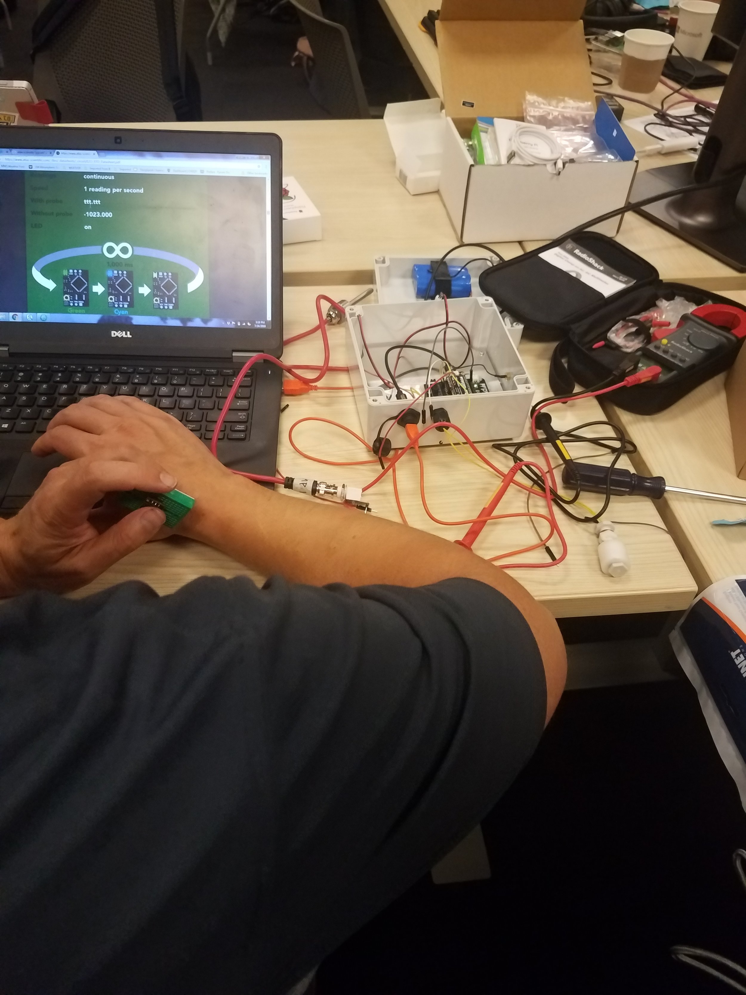
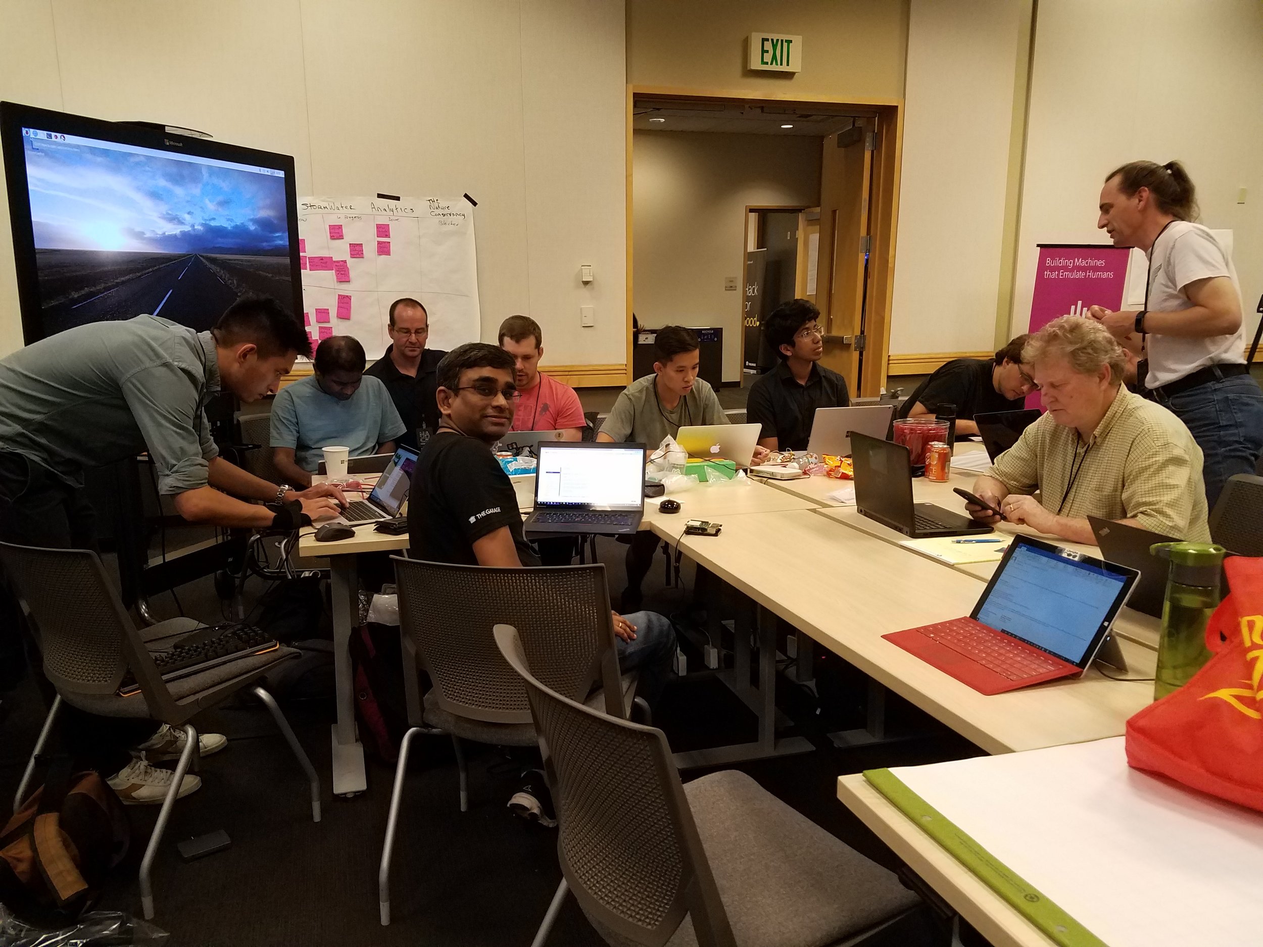
Aspect Joins The Nature Conservancy and Microsoft to Hack for Good

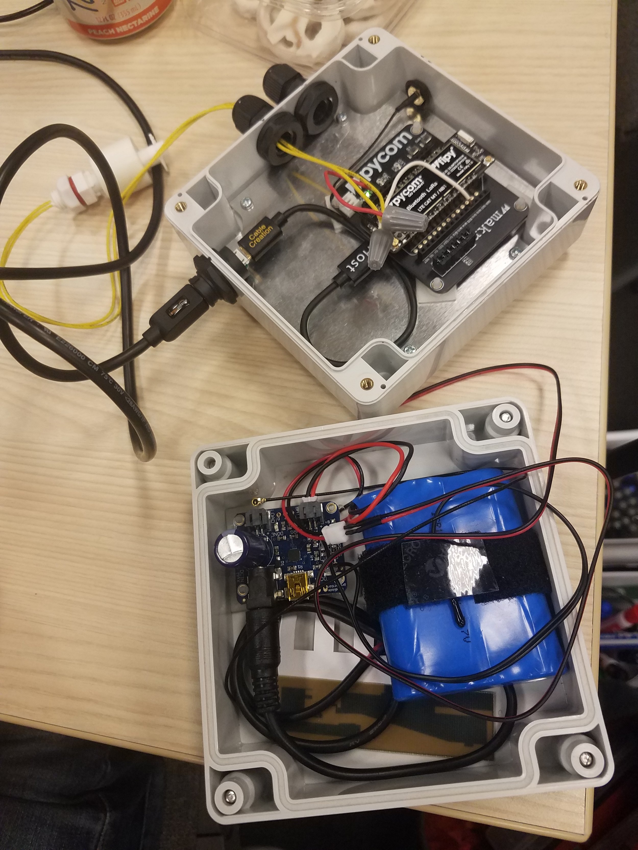
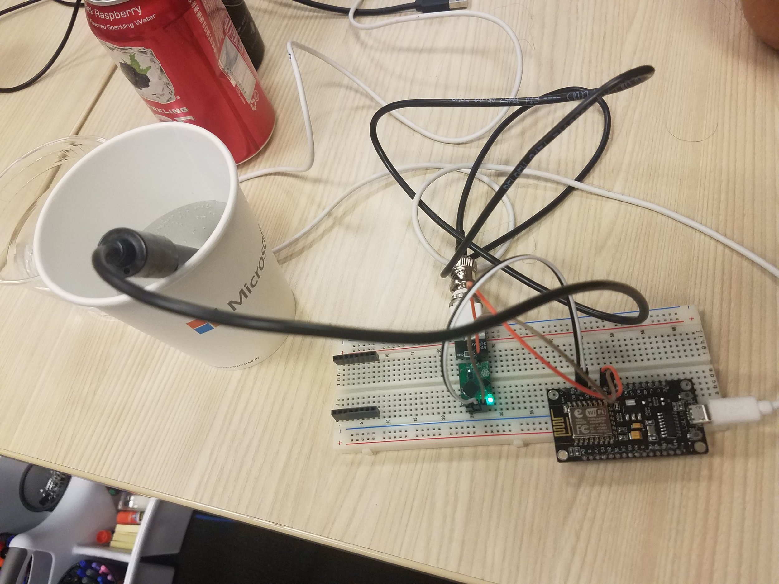
Aspect’s Curtis Nickerson and Bryan Berkompas recently participated in a Hackathon with The Nature Conservancy and Microsoft employees. The Hack for Good event focused on developing low-cost stormwater monitoring solutions that could identify pollutants and collect data in real time.

Read more about this event on the Nature Conservancy's website.

Visualizing Stormwater Infiltration + Visualizing the Story

Aspect recently led a first-of-its-kind approach to help the City of SeaTac (City) understand water quality requirements at the land use planning stage. Aspect, along with Robin Kirschbaum, developed publicly-available webmaps that visualize stormwater infiltration potential at a parcel level across the City’s 10 square miles. These maps will help both City planners as well as developers screen development options with infiltration requirements and make this step of the land use planning process much more efficient.

Take a look at the interactive Story Map for this exciting new tool here: https://maps.aspectconsulting.com/lidmapjournal/index.html.

Read Emelie’s article in the Daily Journal of Commerce about this pioneering project.