

Seattle City Light is about to unveil its new state-of-the-art substation that will transition this South Lake Union site from a Greyhound bus maintenance facility and parking lot into an “architectural marvel.” From property acquisition and contaminant remediation through design and construction, Aspect completed a full range of environmental and geotechnical services to support the redevelopment of a sleek electrical substation wedged in the heart of Seattle’s tech sector.

Recognizing World Water Day
Water is a scarce resource for many worldwide. The United Nations has designated today, March 22nd, as World Water Day to raise awareness of the billions of people—about 3 in 10—living without safe water. As earth science professionals, this message strikes a chord with Aspect staff who spend many of our work hours towards helping clients find, produce, and manage water. Supporting NGO goals – like the UN’s “water for all by 2030” – is important to us. Whether it’s organizations like UN or Engineers Without Borders USA, please join us in learning more about these worthy causes.

International Women’s Day at Aspect
Aspect celebrated International Women’s Day with a gathering and conversation sparked by a video produced by Lean In as part of their 50 Ways to Fight Bias program. The video defined the common biases women experience at work and beyond:
Performance (underestimating women’s experience and performance)
Attribution (women get less credit for success, more blame for failure)
Likability (been agreeable can be seen as less competent, while being assertive can make one less likeable)
Maternal (choosing to become a parent can be seen has having less commitment to career)
Affinity (people tend to gravitate towards people who are similar in appearance and background; when only white men hold positions of power, this has a negative effect on women and people of color)
Compounded discrimination + Intersectionality (the compounding affect of bias due to gender, race, sexual orientation, disability, and other attributes)
Thirty-three percent of Aspect’s staff of 107 are women, including 15 percent of Aspect’s technical/engineering staff, which is slightly higher than the statewide percentages for female engineers –11 percent in Oregon and 12 percent in Washington. In 2018, 21 percent of our technical hires were women.
The theme for International Women’s Day 2019 was Balance for Better, encouraging action towards creating a more gender-balanced world. Some of our staff modeled the “Balance for Better” pose to show our commitment to finding that balance.
Meet Chip Barnett and Peter Price!
Senior Engineering Geologist Chip Barnett and Staff Scientist Peter Price recently joined Aspect—Chip in our Seattle office, and Peter in our Yakima office. Here are five questions we asked to get to know them better.
Chip Barnett - Senior Engineering Geologist

Where are you from? If you’re not from the Pacific Northwest, what brought you here?
I lived in Central and Northern California (stuck in Lodi for most of it) before I pursued a master’s degree at Portland State University. I’ve lived in the Puget Sound area with my family since 2002 and have worked in consulting in the Pacific Northwest since 1998. I think the climate really agrees with me and I like the people. My family has deep roots in Washington and Oregon, so living here just feels right.
What inspired you to pursue engineering geology? What made you curious about it?
I was fortunate to take engineering geology courses at Portland State University with Professor Scott Burns. One class had a series of case histories presented by different visiting geologists, including Jon Koloski and Richard Galster, who enjoyed long careers in our region. The variety of challenging projects and solutions they presented was a great introduction to the field of engineering geology and geotechnical engineering.
My master’s thesis included evaluating potential flooding impacts relative to regional subsidence following a Cascadia Subduction Zone Earthquake in a number of coastal communities in Washington and Oregon. Speaking with some of the local city engineers about an approximate amount of anticipated subsidence and impacts was interesting. It helped me see how these hazards impact infrastructure and public safety.
What do you like best about your area of expertise? What excites you and keeps you motivated?
I enjoy finding opportunities when we can provide an innovative solution that a client really appreciates. I’m excited when I get to work in an area where I may not have worked before and get a chance to read literature or review geologic mapping to think about how that affects our project. Being licensed in Washington, Oregon, Idaho and California has given me many opportunities to work in different areas.
I’ve also worked on a number of corridor studies (pipelines and transmission lines) where the geology and subsurface conditions can vary widely. Those projects are always really interesting, and I enjoy discussing the layout and details of figures with GIS Analysts to meet a client’s needs.
What do you like to do when you aren’t working?
We take our youngest son to a lot of swim meets and an occasional jazz band performance. I enjoy yardwork, hiking, camping, volunteering in the community (professional and local), and attending concerts—and I like to sing really loud at home, annoying everyone except our dog, Cosmo. Yes, I have done karaoke.
Where in the world would your dream home be located?
My dream house would be located on the Washington coast, preferably above elevation ~400 feet to reduce the risk of potential tsunami impacts. The house itself would be a seismically retrofitted Victorian home with solar panels, a small wind turbine, and an on-site well system that could also be used to provide passive heating.
Peter Price - Staff Scientist

Where are you from? If you’re not from the Pacific Northwest, what brought you here?
I was born in Pocatello, Idaho, and raised in Tulsa, Oklahoma. I moved to the Portland, Oregon, area after high school to be closer to my extended family. I have numerous aunts, uncles, and cousins living all over the west side of Oregon.
What inspired you to pursue water resources? What made you curious about it?
I have had a zeal for hydrogeology ever since I took a course at Oregon State University. Water is a valuable resource, and the more I can understand the intricacies of our impacts and ever-growing need for this resource, the more I feel prepared to inform the next generation’s understanding and encourage a respect for and preservation of water.
What do you like best about your area of expertise? What excites you and keeps you motivated?
I would say it is the combination of mental and physical exertion. Collecting field data can be wonderfully refreshing, and physically difficult. When exhausted physically, you can sit down and turn your hard work into other people’s understanding via maps, data table, graphs, reports, etc.
What do you like to do when you aren’t working?
I enjoy going on adventures with my family. My wife, Amanda and our 3-year-old daughter, Aubrey, are usually reluctant towards my overly enthusiastic plan to drive next to some river and “adventure” along the way. After they get out of the car at the first of many stops and witness the natural beauty that surrounds them, they thank me for getting them out of the house, usually.
Where in the world would you like to travel next?
I would like to travel to Antarctica, briefly. Maybe check out the Ross Island Ice Shelf, briefly.
A Thousand Photos to Better Storytelling: The Aspect Photo Contest
In the earth science consulting world, our work is innately photogenic. Stream gauging at a quiet bend in the river. Installing new pin piles at a pier on a scenic city waterfront. Even the “grimy” photos, like well sampling at a contaminated site, provoke interest and fascination. Staff take pictures to document their technical work and those same photos are the lifeblood of firm branding and storytelling. However, Aspect’s marketing team, tasked with telling our firm’s story, can struggle with harvesting high-quality visuals. The photos are out there, yet they may be buried in forgotten file locations or staff’s work phones. Just asking “Have you got any good pictures?” yields scattershot results, which often then means reusing the same tired photos again and again.
So, a year ago, our marketing group decided that we needed a better way to consistently draw out quality photos. What better incentive than a friendly contest?
I love it, it gives me glimpse to what our field people are up to, since I am in the office 100% of the time and not a field person, I envy them the fun they have when in gorgeous location in beautiful weather and not so much when they are bundled in the snow and rain.
- Mirka Ramsey, Accounting Lead
The Idea: Prizes and Public Recognition
We started with a weekly raffle, awarding tickets to all contributors and bonus tickets for the week’s best photos – all leading up to a cash prize drawing and winners that we celebrated at quarterly firm-wide meetings. After the first call for entries, staff responded with 54 pictures. Where had these all been hiding?
If we had only received those first 50 photos, that would have been a modest success. However, we were surprised and amazed that the photos kept coming week after week. We knew we had something special when, at the first quarter’s staff meeting, the photo contest became a highlight. It turned the meeting into an informal art exhibit, where the employees and their beautiful, funny, and, often times, poetic snapshots of field and office life were the stars of the show. The idea continued to gather steam and, by the end of the year, we’d received over 1,100 photos.
It’s awesome! I love seeing the work that other folks are doing. I think it improves our company culture: gives us something to talk about with staff we might not interact with otherwise, and also gives me a better sense of pride in some of the work that I’m doing when I share my photos.
- Hannah McDonough, Staff Geologist
The Takeaways
One thousand photos later, if there’s one general takeaway, it’s that being curious and asking staff what they are working on—and learning what they’re excited about—is always worthwhile. The photos gave our marketing team materials to help tell Aspect’s story, but also delivered an unexpected benefit: they shone a light on firm culture. Over the photo contest’s first year, we found that:
The field staff’s photos remind everyone of the aesthetics of working in environmental consulting – they are outdoors a lot in both beautiful settings and grimy conditions. It’s a way to appreciate the beauty and commiserate when things are grim.
It’s not just about the projects. We got many photos of what staff are doing outside of work –biking trails, climbing mountains, running races, vacationing in places sunnier than the Pacific Northwest.
Sharing our work brings staff of all levels together around firm culture and put names to faces before people may have met in person.
Aspect staff are now in the field, at industry functions, or just in the office, with an eye out for photo opportunities.
Submitting on a regular basis helps keep taking photos in the front of my mind so I have more photos of my projects which helps when putting together reports. I enjoy seeing others as it gives insight into what the rest of the company is up to. I often get a sense of a “can-do” attitude mixed with people enjoying what they are doing.
- Bryan Berkompas, Senior Hydrologist
A Hub for Storytelling
As the photo contest enters Year Two, the marketing team now has an established source of photos to illustrate our work in proposals and spotlight our culture for recruiting. Field staff have told us that taking photos helps them with their project work and report writing. And everyone enjoys seeing what our colleagues are up to and takes pride in our collective work.
Follow our photographers on Aspect’s Instagram page.


Meet Daniel Babcock!
Staff Scientist Daniel Babcock recently joined Aspect’s Seattle office. Here are five questions we asked to get to know him better.
Daniel Babcock - Staff Scientist

Daniel Babcock in Farmington, New Mexico
Where are you from? If you’re not from the Pacific Northwest, what brought you here?
I was born in Wichita, Kansas and had lived there my whole life up until now. After living in a place with no trees or mountains for 26 years, my wife and I decided it was time for a change of scenery! Western Washington satisfied everything we were looking for in a new home i.e., opportunities, mountains, trees, and multiple Chipotle locations.
What inspired you to pursue environmental science What made you curious about it?
My background is in Geology and I fell in love with learning about the natural word—I also knew I didn’t want to work behind a computer 24/7. It seems to have worked out perfectly that I was able to find a career that allows me to combine my love for science while allowing me to work both in and outdoors.
What do you like best about your area of expertise? What excites you and keeps you motivated?
At the end of the day, it is rewarding work. There is a sense of pride that goes along with being part of a team that remediates sites and knowing that you contributed to that. It is work that feels bigger than yourself.
What do you like to do when you aren’t working?
I enjoy most things outdoors—hiking, backpacking, mountain climbing, camping, kayaking, downhill mountain Elk riding…well maybe one of those isn’t a real activity… yet. But, I also enjoy playing a few instruments like the guitar, bass, and ukulele.
Where in the world would you like to travel next?
It may not sound as cool as saying Paris or Australia but, I have always wanted to visit the New England area of the United States. I love history, and as far as the USA goes, there is a lot of history out there and I have never been out east before. So, Vermont, New Hampshire, Maine, and Massachusetts are high on my list.
Aspect to Showcase Cutting-Edge Stormwater Technology at the Upcoming NEBC Stormwater Conference
What’s new in stormwater technology? Aspect staff will discuss some of the tools helping municipalities and industrial facilities manage stormwater in the Science Research portion of the NEBC Managing Stormwater in Washington conference, being held in Tacoma on Wednesday, March 6.
Aspect’s Senior Associate Water Resources Engineer Tom Atkins will moderate the “Expanding the Toolbox: Emerging Technologies” panel, with presentations by Aspect’s Associate Data Scientist Parker Wittman and Senior Environmental Scientist Brad Kwasnowski.
Their presentations will explore new technologies and applications in the stormwater world, including advancements in:
Comprehensive monitoring networks harnessing the power of cloud technology
LID BMP infeasibility web maps streamlining land use planning
Real-time field testing for heavy metals powered by DNA
Permeable pavement enhancements providing cost-effective improvements
Forensic analysis – steps towards fingerprinting
Aspect is also a proud sponsor of the conference. You can learn more about it here, and if you’re attending, make sure to stop and say hello!
From Brownfields to 500 Units of Affordable Housing – Aspect in the News
The Daily Journal of Commerce takes a look inside Mt. Baker Housing Association’s pioneering affordable housing work in South Seattle. Aspect, overseeing the environmental effort for the MBHA team, continues to drive the idea of brownfield sites as unique opportunities for affordable housing – including the 160+ unit Maddux project and the 350+ unit Grand Street Commons project.
Learn more: www.aspectconsulting.com/affordablehousing
The $82 Million Icicle Creek Subbasin Watershed Plan Hits a Milestone
This Seattle Times article provides an in-depth look at the complex mix of aging alpine dams, world-renowned wilderness area, and the potential of changing climate patterns in the Icicle Creek Subbasin. The spotlight’s on this North Central Washington region as the 6+ year Icicle Creek Subbasin strategy hit a recent milestone with the release of the project’s Programmatic Environmental Impact Statement.
Since 2012, Aspect has been the facilitation and technical lead for this effort, serving a broad working group of city and county agencies, tribes, fisheries, irrigators, and the community. The overall program is designed to improve instream flows, assist in agricultural sustainability, and provide for local domestic growth beyond the year 2050 at an investment of $82 million over the next 10 years.

Tales from Bertha: Till, Fill, and Dewatering
As Seattle weathers the close of one historic stretch of Highway 99 and awaits the opening of a brand new one (at the time, the largest soft-ground tunnel bore in the world), we’re recapping a tale that played out in connection to one of the more dramatic milestones of the tunneling project: Bertha gets stuck.
In December 2013, the mega tunnel boring machine known as Bertha overheated and broke down 1,000 feet into its journey. Eager to keep the project moving, crews working for Washington State Department of Transportation (WSDOT) quickly designed and excavated a deep rescue shaft to get in front of the stuck machine and repair it. It was a complicated effort to drill down to Bertha considering the unique geology and human history that has defined Seattle’s waterfront.
Peering into the 130-foot-deep rescue shaft. Photo credit: Seattle Times
How an Inch of Displacement Can Cause Trouble
Stabilizing the ground to create the 130-foot-deep shaft required a significant amount of dewatering [1] that had to be done quickly. This dewatering caused the surrounding soils to settle much more than was anticipated from the planned tunnel construction—the settlement reached over a wide half-mile radius, and about an inch in some places, and even more than that close to the shaft.
An inch may not seem like a lot, but for the underground maze of City of Seattle (City) utility infrastructure, including aging, brittle water and sewer lines (some over 100 years old), any additional settlement was problematic. This unforeseen settlement was enough to trigger an expedited program to assess and replace the utilities where risks were unacceptably high. The City, in need of expertise on local geology, hydrogeology, tunneling, and soil behavior, brought on Aspect to investigate problems resulting from the rescue shaft construction and help design repairs.
The aerial image of the Seattle waterfront shows locations of satellite radar altimetry points TRE Altamira used to measure precise changes in ground surface elevation from May 2014 through February 2015, which included the period of Bertha rescue shaft dewatering. The colors of the dots represent the cumulative change in elevation, with hot colors showing subsidence and cool showing uplift. The orange and red areas show the broad pattern of ground subsidence associated with the shaft dewatering. For more information on this technology, visit TRE Altamira.
Aspect’s role was four-fold: determine what parts of the City’s infrastructure were being most affected by the settlement; assess vulnerability of other areas further along the tunnel route; assist with geotechnical engineering recommendations for replacing infrastructure damaged by the settlement; and help the City understand the cause of the settlement.
Till + Fill + Development = Complex Subsurface Challenges
Our investigation started with an extensive review of the waterfront’s underlying geology. Deep beneath the City lies a complex history of multiple glacial advances and retreats, separated by long interglacial periods. Sediments from glaciations include tills, layers of glacial lake and marine silts and clays, and sheets of glacial outwash sand and gravel. These glacial soils are interbedded with floodplain silts and sands and gravelly channel deposits transported by rivers flowing from the surrounding mountains, including lahar deposits (large volcanic mudflows) from as far away as Mount Rainier.
These strata were deposited in more-or-less horizontal and generally orderly ways, then subsequently compressed and compacted by repeated advance of glacial ice sheets. In the Pioneer Square area, a present-day look at the resulting stratigraphy is, however, far from orderly, due to its setting within the Seattle fault zone. This zone of tectonic compression repeatedly ruptured during prehistoric earthquakes, and much of the strata are now sheared, tilted, overthrust, and truncated. All of this was then overlain by weak estuary, beach, and tide flat deposits—and then extensively modified by humans.

This map shows the rescue shaft – and the southern portion of the tunnel route – in or below what was formerly the beach and tide flats of Elliott Bay. Pioneer Square was a tidal marsh area. These areas were infilled over the century with sawmill wood waste and soil fill, making the ground throughout the (now) Pioneer Square area both geologically and historically complex. Map credit: Aspect
A major part of Aspect’s analysis focused on the location, thickness, and nature of the weak and shallow soils draped above the strong glacial soils, intertwined with the historical changes that occurred as Seattle developed its waterfront. The Pioneer Square area was a small upland Native Americans had lived on for millennia. Occidental Square was a shallow coastal lagoon, and most of the area south of King Street was tide flats. As timber and shipping industries flourished in the 1800s, much of the waterfront was developed with piers and trestle bridges, then filled with sawdust and wood waste from waterfront mills and soft muck sluiced from nearby hills.
On top of all that, roads, sewer lines, water lines, and buildings were constructed on the new ground. Not surprisingly, these weak fills have settled over time, resulting in bumpy roads, tilted sidewalks, and tall curbs in the Pioneer Square neighborhood. But these same soils were also highly susceptible to further consolidation when the water table was rapidly lowered by the Bertha rescue shaft dewatering.
Historical Record Sleuthing
To assess the areas of vulnerable underground utilities, we dug into the historical records—maps dating from the original land surveys of Seattle to locate the original shorelines, and previous drilling investigations going back decades to reveal the subsurface data. Aspect compiled soil records of hundreds of borings and wells to develop a database that could be mapped in three dimensions and used to identify the areas where weak soils were present. When combined with the City’s utility maps, Aspect’s weak-soils map allowed the City to easily spot areas where weak soils and vulnerable infrastructure overlapped.
Aspect also assisted the City in pursuing remote surface elevation surveying techniques including use of synthetic aperture radar (InSAR), a satellite-based radar distance measuring technique that permits detection of precise changes in ground surface elevation over time. These studies looked at time-series analysis of data beginning well before tunneling started through shaft dewatering and continuing to the time of the study. They showed an unmistakable correlation between rescue shaft dewatering and broad areas of ground settlement.
Dewatering: The Science of Making a Wet Excavation Dry
Dewatering the excavation required pumping, but at a rate and depth to keep water pressure low (too high could risk “blowing out” the bottom of the 130-foot-deep shaft). There are two aquifers beneath the rescue shaft site and Pioneer Square area – one shallow and one deep. Because the shaft bottom sat in the “deep” aquifer, pumping targeted that aquifer, which was thought to be confined from the shallow aquifer and the vulnerable utilities sitting above it.
However, because settlement happened in the shallow aquifer area, Aspect’s forensic analysis looked at answering several questions: how susceptible are the utilities to pumping a deep aquifer? Does pumping the deep aquifer cause dewatering of the much shallower aquifer? And if so, does pumping the deep aquifer or dewatering the shallow aquifer cause most of the settlement that the City was observing? Understanding the hydrogeologic connections between pumping the two aquifers and the net effects of dewatering on soil behavior required multidisciplinary consideration of many factors.
This graph from TRE Altamira shows the elevation of a single point on the map near the area of greatest ground subsidence. The dots show the date of the satellite pass, and the elevation difference from the baseline series. The sharp drop in elevation between October and December 2014 corresponds to the period when shaft dewatering began. These satellite altimetry data correlated well with elevation control data collected by others using traditional on-the-ground surveying methods.
To understand the amount of shallow dewatering that had occurred, Aspect developed a comprehensive groundwater monitoring program that instrumented existing wells to collect data while the dewatering pumps were running. Then, once the pumps were shut off, before and after comparisons of water levels could be made to see the changes brought on by dewatering. Data collection continued until dewatering had ceased and groundwater levels had returned to normal.
Fixing the Faults Caused by the Fault
Ultimately, the project team concluded that there had been localized impacts to the shallow aquifer that were related to pumping of the deep aquifer. Some of those impacts were the result of leakage from the shallow aquifer downward along the outside of the Bertha rescue shaft, and some from leakage between the shallow and deep aquifers that occurred along zones of disrupted strata that the Seattle fault created to form the complex geology below Pioneer Square. The data collected by our team provided strong support that the Bertha shaft dewatering caused enough settlement to require replacement of vulnerable utilities. This led to a program in 2015 to replace the large water main buried below Western Avenue, with Aspect providing the geologic analysis used for the design. The drive along Western Avenue is now much smoother, and the section of new water main is now less vulnerable to the next big construction project or major earthquake.
Ironically, while past activity along the Seattle fault was largely responsible for the complex hydrogeology that made dewatering the Bertha rescue shaft a challenge, it was concerns about future rupture of the Seattle fault (or one of the other regional faults) that triggered replacing the Viaduct with the tunnel to begin with. This in turn led to the rebuilding of the waterfront seawall and reconstruction of Pier 62.
As some Aspect geologists are fond of saying – “geology explains everything.” With a site as complex as the Seattle waterfront, it takes an expert “read” of the geology and a skilled team of geologists, hydrogeologists, and engineers to inform design for projects that make Seattle safer and better for the future.
The Waterfront’s Next Chapter – Highway 99 Tunnel
While the water main beneath Western Avenue was being replaced and groundwater monitoring continued, WSDOT crews had Bertha repaired and chugging along beneath the city, breaking into daylight near South Lake Union in April 2017. Seattle now awaits the opening of the tunnel Bertha cleared that will move traffic through the complex web of geology, hydrogeology, infrastructure, and development that makes up the Seattle waterfront.
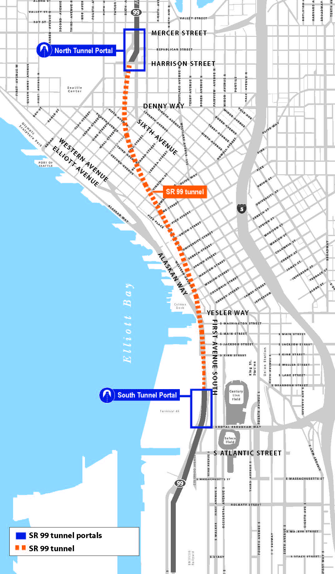
WSDOT’s map shows the new Highway 99 tunnel through downtown Seattle to South Lake Union. Map credit: WSDOT
Environmental Consulting Lessons Learned from the World of Analytical Chemistry

The story of environmental consulting projects often start with what the laboratory results tell us. However, all results are not created equal, and it’s important to know the big picture – site subsurface conditions, regulatory criteria, and chemistry principles – when uncovering culprit contaminants.
At one of Aspect’s recent, ongoing Technical Exchanges, Staff Scientist Andrew Yonkofski invited Mike Erdahl from Environmental Laboratory Friedman and Bruya to discuss the role of analytical chemistry in environmental consulting, including general petroleum chemistry, gas chromatography, and interpreting those results. Part of the discussion was focused on an Aspect-specific case study from a Seattle-area waterfront site. This site presents a unique look at how organic matter in the subsurface can affect results from the NWTPH-Dx analysis.
Lessons learned from the talk included:
Common petroleum hydrocarbon mixtures, such as gasoline and diesel, contain thousands of unique organic compounds. The NWTPH-Gx and NWTPH-Dx analytical methodologies attempt to capture the wide range of organic compounds found in petroleum hydrocarbon mixtures.
While the laboratory provides a reproduceable, quantifiable number for total petroleum hydrocarbon (TPH) results, those results often need to be interpreted in light of the chromatographic results. For instance, the higher boiling end of gasoline overlaps into the diesel-range. As the gasoline weathers, the proportion of material in the diesel range increases in relation to the total TPH value. Qualifying the diesel results as overlap from gasoline contamination can reduce the number of site-specific contaminant of concerns.
Likewise, results using both the NWTPH-Gx and NWTPH-Dx methodologies can sometimes include organic compounds from natural sources including degradation of organic material in the subsurface.
To properly characterize a site, environmental consultants must use multiple lines of evidence to determine the nature and extents of contamination. This includes interpreting analytical results and the associated chromatograms in the context of the historical site use.
This chromatogram illustrates how gasoline can overlap into the diesel-range. The diesel results reported by the lab do not indicate a separate diesel release from the gasoline release but rather illustrate how gasoline can overlap into the diesel-range as the product becomes weathered in the subsurface.

This example shows what a chromatogram may look like when there are multiple sources (both gasoline and diesel) present in a sample.
Meet Nick Iapalucci and Henry N. Haselton!
Technical Support Specialist Nick Iapalucci and Staff Engineer Henry N. Haselton (definitely a relation to his uncle, Aspect’s Principal Geotechnical Engineer Henry Haselton) recently joined Aspect’s Seattle office.Here are five questions we asked to get to know them better.
Nick Iapalucci - Technical Support Specialist

Nick Iapalucci, Technical Support Specialist
Where are you from?
I grew up in Carrollton, Texas and went to college in Santa Fe, New Mexico. My wife and I were ready to expand our careers and our son was starting middle school, so after finding work in Seattle we decided to make the move!
What inspired you to pursue Technical Support. What made you curious about it?
I have been in a support role in wide variety of fields: outdoor recreation, film, theater, radio, social work, childcare, and information technology. I enjoy helping people and solving problems.
What do you like best about your area of expertise? What excites you and keeps you motivated?
I think this is a very exciting time to be working with information technology! With our advances in virtualization and connectivity, I think possibilities have expanded farther than we can imagine at this point.
What do you like to do when you aren’t working?
I have family in California, Colorado, Texas, Pennsylvania, and Massachusetts so traveling is a popular activity. On the weekends we camp, hike, bike, paddle, or whatever else we can come up with outside.
Where would your dream house be located?
Nowhere permanent! Our dream house will probably be an RV someday.
Henry N. Haselton - Staff Engineer
Henry N. Haselton rating the Grand Canyon.
Where are you from? If you’re not from the Pacific Northwest, what brought you here?
I grew up on the coast of Maine in a small town called Rockport. I spent the last 7 years in Bozeman, Montana, before coming to Washington. I came to the Northwest because I love the combination of the big mountains and the ocean.
What inspired you to pursue geotechnical engineering? What made you curious about it?
I was initially drawn to civil engineering because of my interest in math and science and a desire to apply these fields to real-world problems. I have always enjoyed problem solving, so civil engineering made sense as a field to pursue. Within civil engineering, I was attracted to geotechnical engineering because of the highly variable nature of soil and rock between different locations. I have always been drawn to the outdoors, so working in an engineering field that involves site-specific field investigations and learning about varying ground conditions is a great fit for me.
What do you like best about your area of expertise? What excites you and keeps you motivated?
I like that geotechnical engineering requires lots of field work and site investigations to determine the specific conditions in a given area. I enjoy learning about the natural world surrounding us and how to allow humans to inhabit places safely and sustainably. The spatially variable soil conditions and hands-on investigation keep me motivated and interested. I am excited to learn more about the geology of the Pacific Northwest and be able to apply it to geotechnical engineering.
What do you like to do when you aren’t working?
I enjoy a wide variety of outdoor recreation, including skiing, mountain biking, hiking, backpacking, and fishing. I am trying to spend more time learning some water sports such as white water rafting and surfing. I am excited to live in the Pacific Northwest so I can explore new areas for skiing and other activities.
Where in the world would you like to travel next?
There are lots of new places I would like to visit and many I want to revisit as well. Near the top of my list for new places to travel would be doing a ski trip to Chile and Argentina in our summer (winter in the southern hemisphere).
James Packman Talks Interdisciplinary Skills and Water’s Role in Urban Environmental Planning to UW Class
Senior Hydrologist James Packman recently presented to “Planning as a Profession,” a senior-level urban planning class in the College of the Built Environment at the University of Washington. The nearly 30 students come from different majors and career trajectories—among them are future architects, landscape architects, city planners, urban designers, real estate professionals, construction managers, engineers, environmental scientists, and more.

James Packman, Senior Hydrologist
James’ presentation, entitled “Environmental Skills, Water Resources, and Urban Planning,” gave a holistic view of environmental considerations in urban planning—from the skills and interests that lead a person to the profession and the different disciplines working in the industry to the laws and regulations that drive project design, permitting, and building and examples of water-focused planning. His overarching message focused on interdisciplinary skills, and he gave examples of Aspect projects where collaboration between disciplines was vital to address the environmental elements.
For example, the Waypoint Park project along Bellingham’s shoreline incorporated coastal geology, hydrogeology, stormwater management, civil and geotechnical engineering, landscape architecture, habitat restoration ecology, and more to reclaim a contaminated former industrial site to an urban waterfront park.
Waypoint Park Before and After Construction
City of Bellingham’s Waypoint Park incorporated many environmental planning steps to turn a former industrial site into an urban waterfront park.
James also introduced the practical side of business consulting, or how people and firms pursue and win public work, and walked students through the Request for Qualifications / Request for Proposals process. His key message for being on winning teams is that it requires networking in and outside of one’s discipline and forging relationships with public agency staff to learn their needs.
He ended by going over a homework assignment about the State Environmental Policy Act (SEPA) checklist process and its key role in urban planning projects. The homework reinforced the variety of environmental disciplines—geology, hydrology, archeology, botany, wildlife biology, engineering, and more—along with professional skills—technical reading comprehension, writing, project management, public speaking, quantitative analysis, and more—that are needed to complete the checklist.
James will present to a new set of students when he returns to the class in Spring Quarter 2019.
Dan Haller Presents to the Water Mitigation Task Force
Aspect is routinely involved in helping inform State policy makers on implications of existing and proposed legislation. Our staff track and comment on existing legislation, help our clients propose new legislation, and interact with State agencies as they propose and shape new water policy. Aspect’s Dan Haller was asked in the summer of 2018 to provide a presentation on mitigation projects and mitigation sequencing to the Washington State Joint Legislative “Water Mitigation Task Force”. This Task Force is charged with evaluating how the law could be changed to adopt mitigation standards for water projects where water-for-water cannot be supplied for a project in-time and in-place. Often the “in-time” component of mitigation is the most challenging element as supply and demand are hard to match perfectly.
Dan speaks about several mitigation projects Aspect staff have worked on in recent years, including:
Town of Twisp / Methow Valley Irrigation District, which paired an irrigation project rehabilitation with water banking to offset growth in the Town for the next 20 years.
Lake Roosevelt Drawdown, which re-operates Grand Coulee Dam by 1 foot making that supply available for agricultural reliability, instream flow, and municipal use.
Kittitas County Consumptive Use Pilot, which seeks to clarify the exact nature and magnitude of indoor domestic use.
Chelan County Alluvial Storage Pilot, which seeks to engineer natural storage log jams to retime water from spring to summer.
Check out the video of Dan’s presentation below.
Innovative Affordable Housing Solutions Continue in South Seattle
The Seattle City Council recently approved the 2nd Redevelopment Opportunity Zone (ROZ) in Seattle’s history for the 700-unit Grand Street Commons housing development near the future Judkins Park light-rail station. The ROZ designation means that this innovative $20 Million private/non-profit partnership (Lake Union Partners and Mt. Baker Housing, respectively) now has direct access to state funds to build a 700-unit development—with about half of those units earmarked for affordable housing. These 350 future units, together with the 160 units planned at The Maddux (the City’s first ROZ zone near the Mt. Baker light-rail station), brings 500+ ROZ-designated affordable housing units coming online in the next five years in South Seattle.
The 700-unit Grand Street Commons is a unique private/public partnership, where approximately half the units will be affordable housing. The cleanup for this brownfield site is being led by Aspect and funded by a new approach to access money specifically for affordable housing projects.
Aspect, with law firm Perkins Coie, has helped Mt. Baker Housing pioneer this ROZ model to unlock state-backed grant funding in a first-of-its-kind model. Recognizing this success, the state introduced the Healthy Housing Program this fall– earmarked specifically for affordable housing developers looking at restoring land at brownfield sites.
Learn more about new approaches to restore land and find solutions for our affordable housing crisis here: www.aspectconsulting.com/affordablehousing.
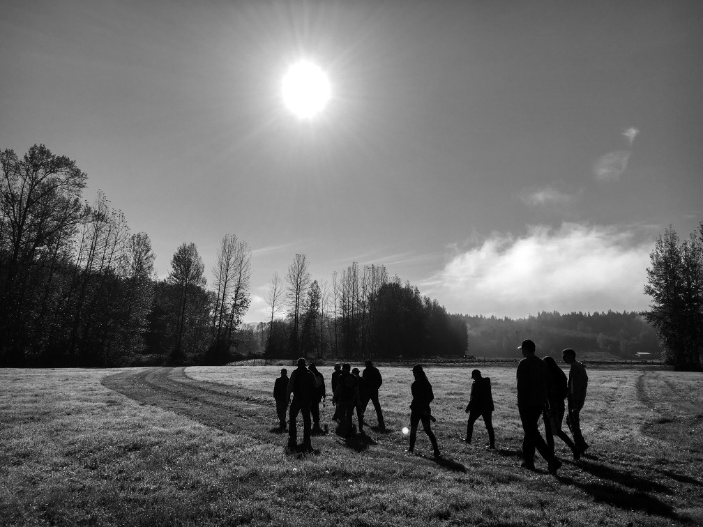
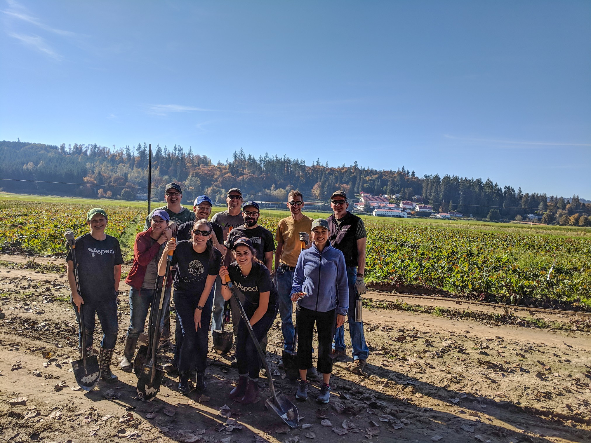
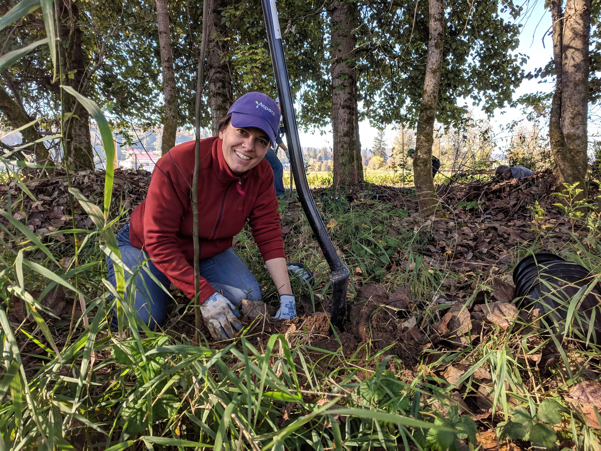
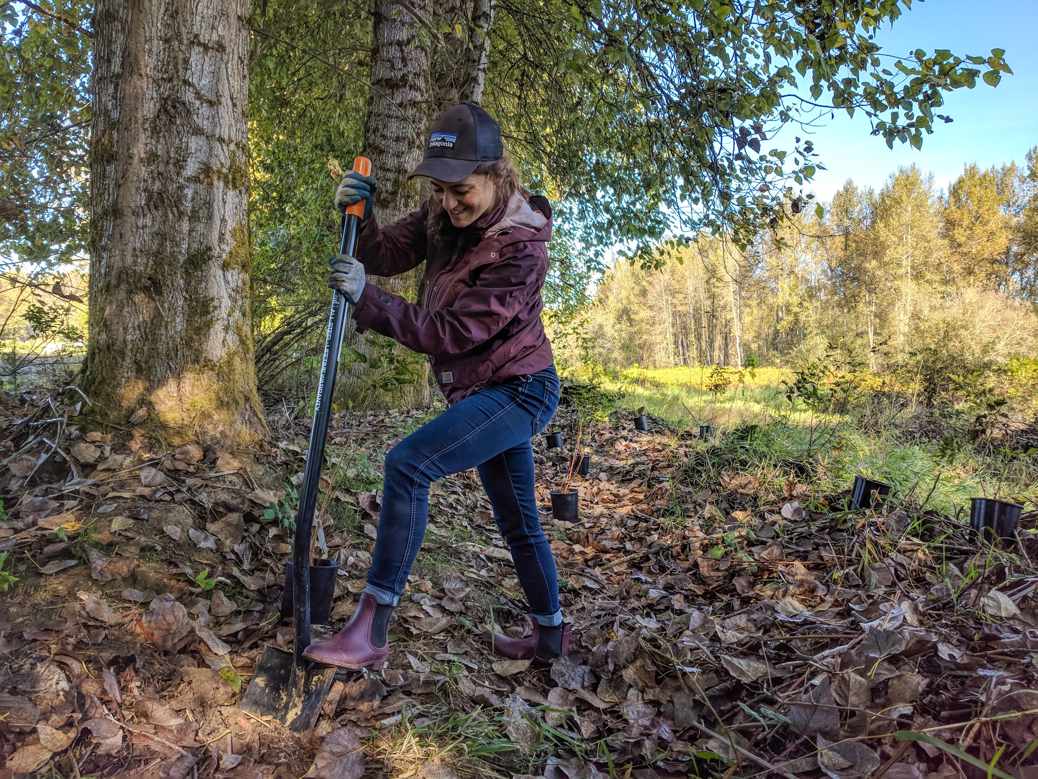
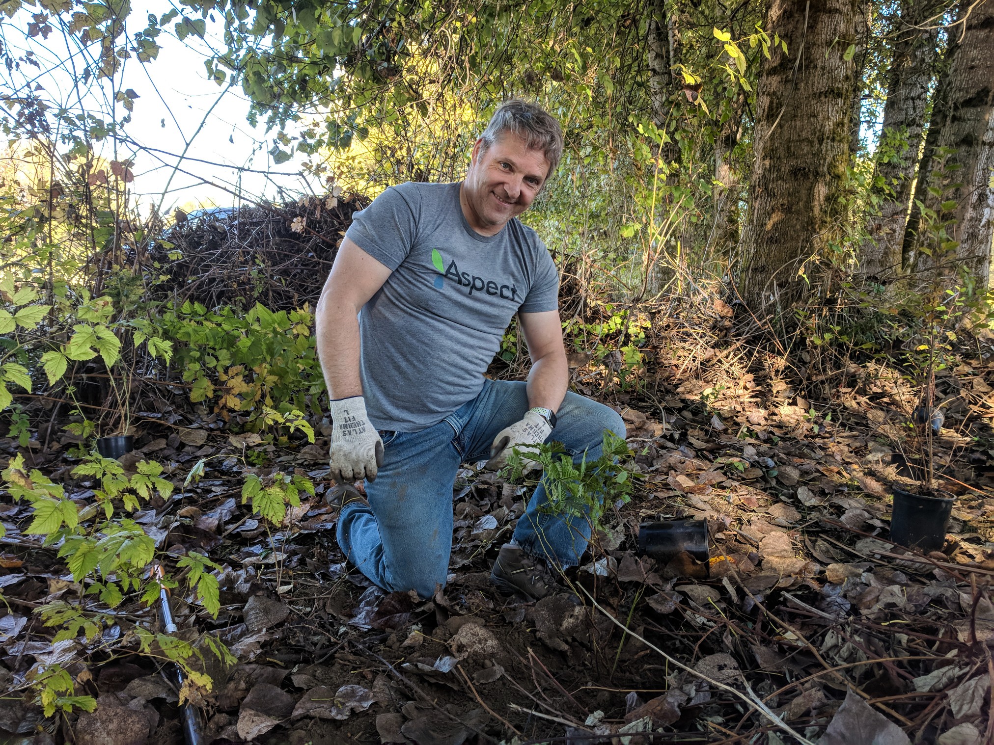
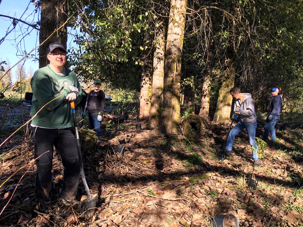
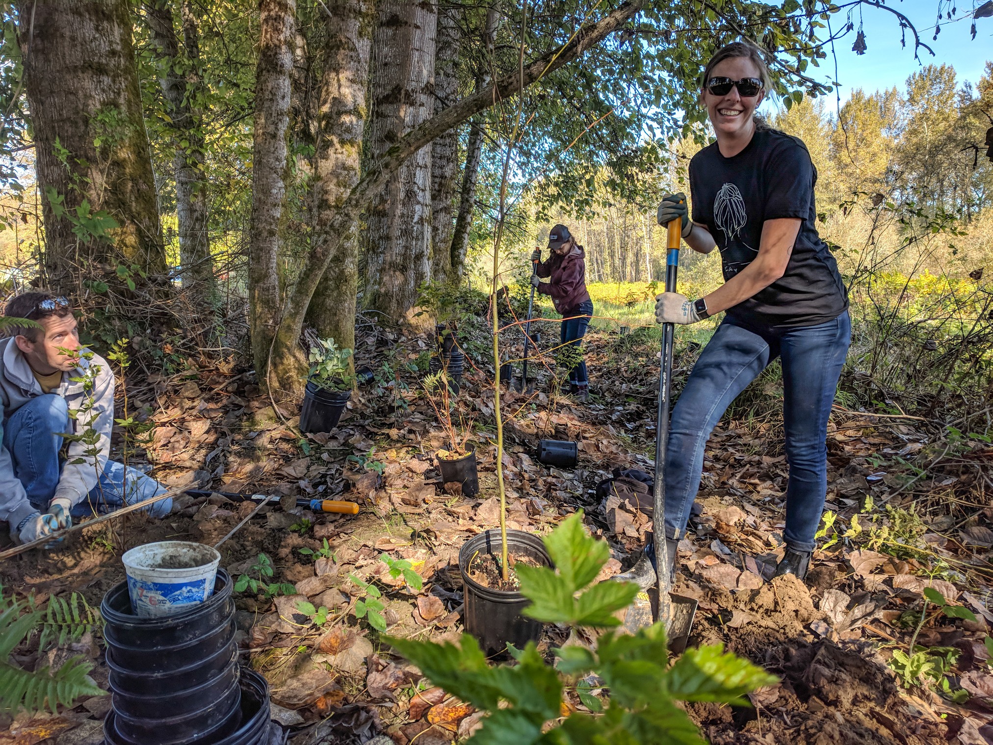
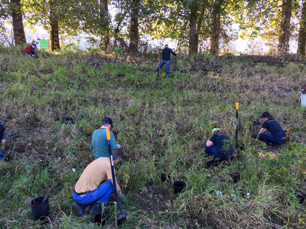
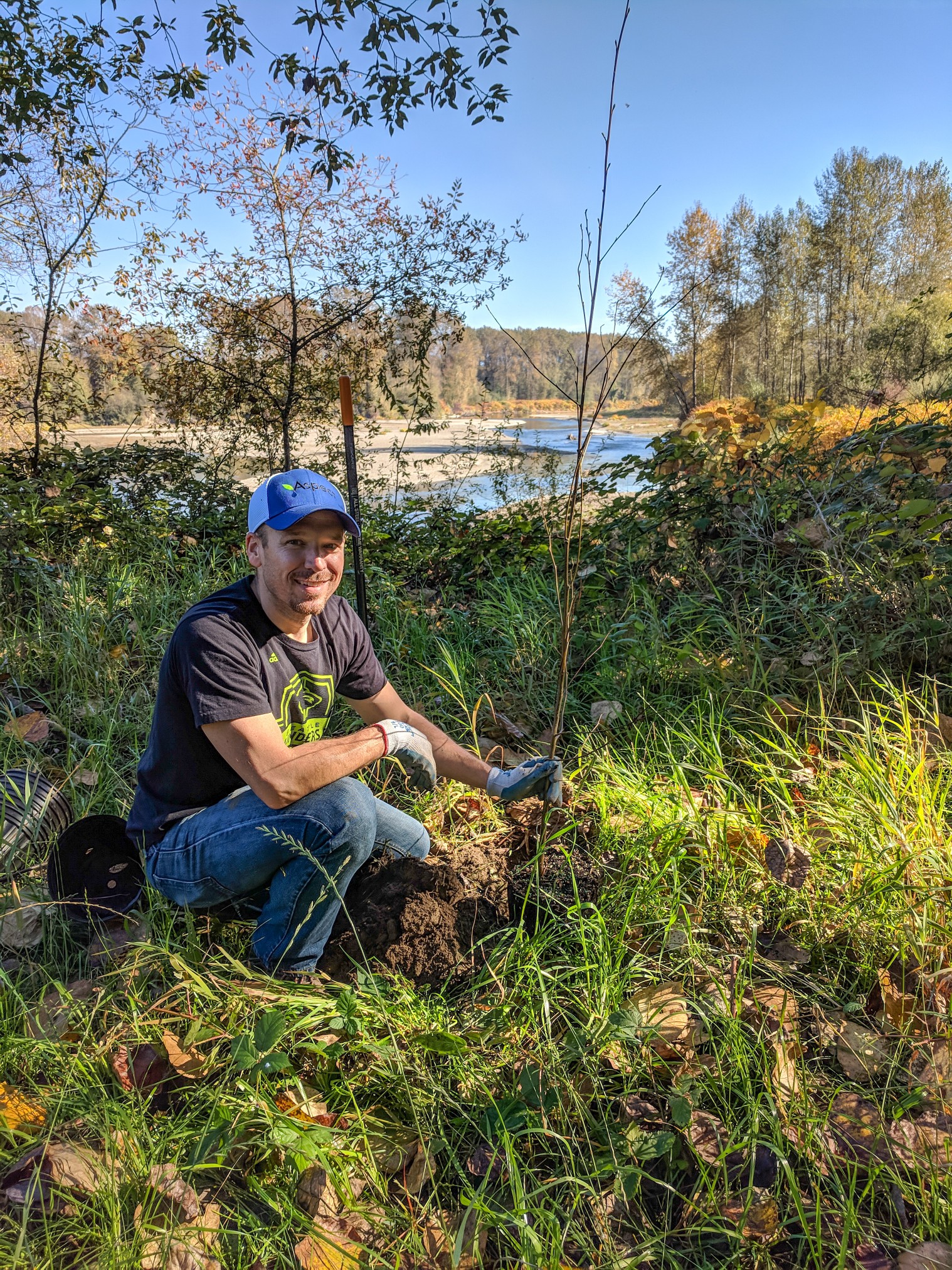
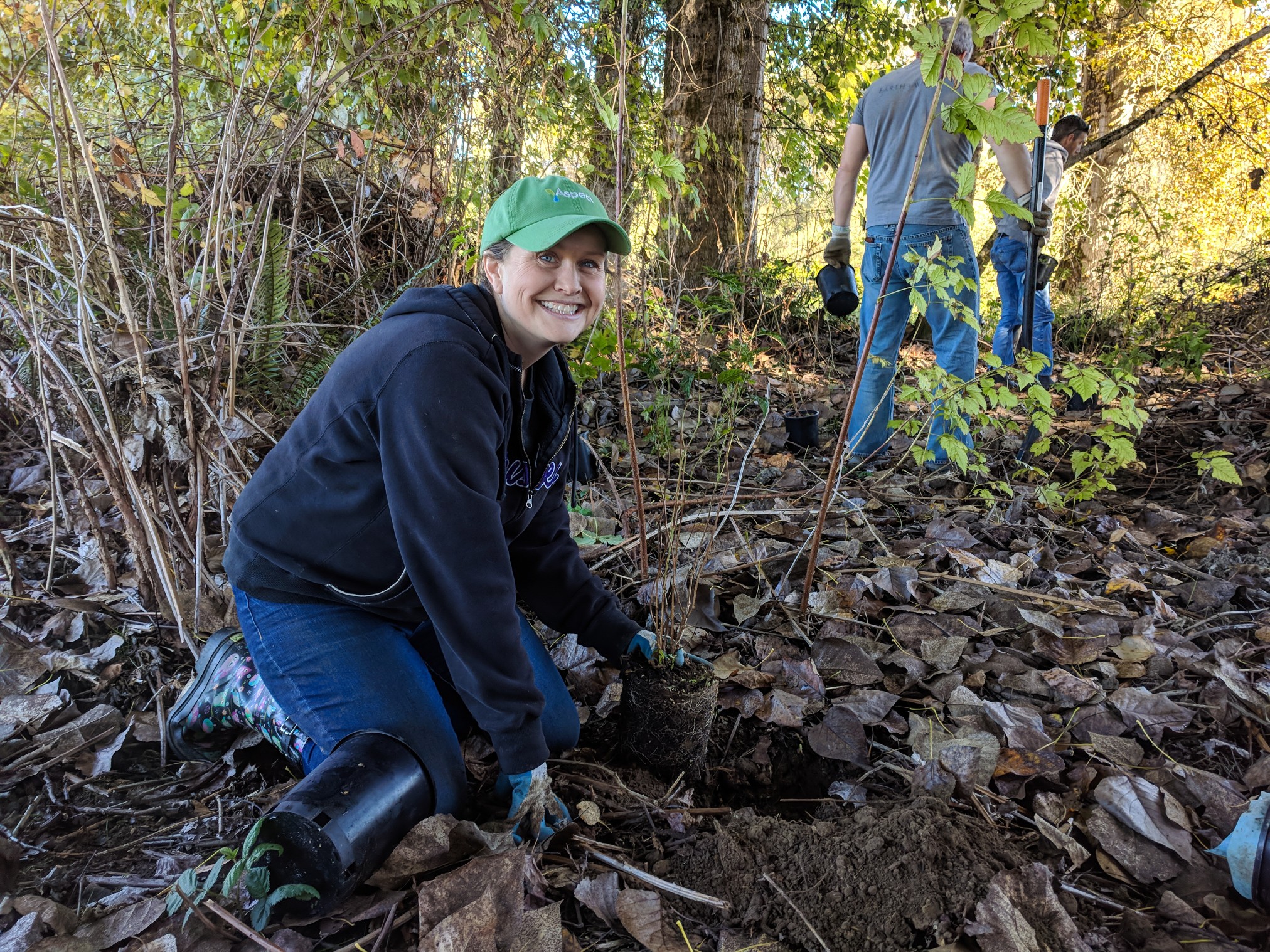
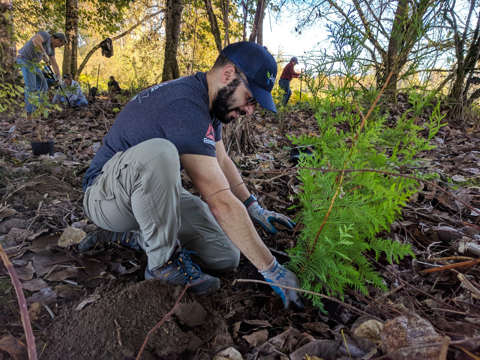
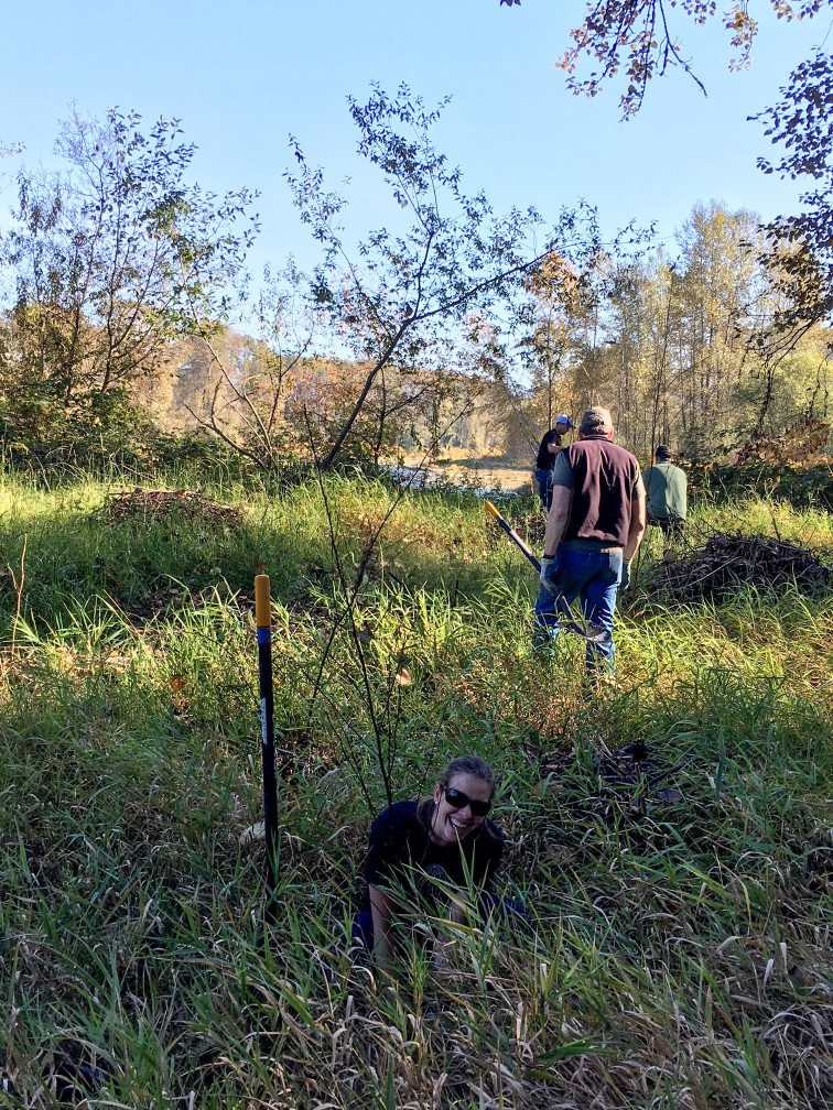
What to Do When Your Office Moves: Plant 900 Trees
Taking advantage of a day out of the office during our Seattle office move, the Aspect Community Team (ACT) partnered with Stewardship Partners and Carnation Farms to help with their ongoing riparian restoration efforts along the Snoqualmie River. It was a sunny, beautiful October day, and the fall colors were rich throughout the valley. Eleven employees make the trek to Carnation and spent a few hours planting shrubs and trees including western red cedar, snowberry, salmonberry, and cottonwoods. We had help from four stewardship partner field crew who also placed cottonwood stakes among the trees and shrubs.
Aspect’s volunteer staff donated their day to plant over 900 trees along the Snoqualmie River to help Stewardship Partners and Carnation Farms.
Why Carnation Farms? A brief history:
In 1908, the first 360 acres of farmland were purchased, and Carnation Farms was created. Now the farm totals 818 acres and includes an 8-acre organic garden, educational programs, event space, hiking trails, and is bordered by a stretch of the Snoqualmie River. A byproduct of the agricultural growth in the region was the destruction of the natural riparian ecosystems along the river throughout the valley. Stewardship Partners has been working with Carnation Farms to restore the habitat along the Snoqualmie River as a component to their adopt-a-buffer program.
Why is riparian habitat restoration important?
Planting native trees and shrubs is the primary component of restoration and maintenance of healthy riparian ecosystems. As Stewardship Partners explains, the strips of native trees and shrubs provide cooling shade, control erosion and provide habitat for hundreds of fish and wildlife species. Trees and shrubs actively absorb air pollution throughout their lifetime, storing carbon and fighting climate change.
What is the impact of a half-day of service?
In about 3-4 hours of diligent work we planted 960 shrubs, trees, and stakes across approximately 0.5 acres of riparian habitat along the Snoqualmie River. This effort would have taken at least a week without the ACT volunteers. Stewardship Partners will do some maintenance the area and in about a year we should be able to see if our efforts truly take root.
Previous and ongoing ACTivities and service projects:
Aspect has partnered with Stewardship Partners previously for the design and installation of the Carnation Elementary School raingarden. The raingarden installation is part of a greater 12,000 Rain Gardens effort, and Aspect is also in coordination for another volunteer raingarden project! Stewardship Partners has been a great organization to work with and Aspect is a proud supporter-- pro-bono technical design, education and consulting services, volunteer labor, and funding.
November 1 at NWGIS 2018: The Art of the Helpful GIS Presentation
Associate Data Scientist Parker Wittman and Senior Geospatial Data Scientist Blair Deaver will be on a panel — “The Art of the Helpful GIS Presentation” — this Thursday at NWGIS 2018 in Bremerton. The four-person panel presents on tips and techniques to deliver a GIS presentation at a conference or at the office. Parker will discuss ways to improve the delivery of a presentation and Blair will present on tips to master a successful technical demonstration.
ESRI President Jack Dangermond is giving the highly anticipated keynote speech at this year’s conference on the future of GIS.
Reducing Risk and Uncertainty: A PCE Site, a Model Remedy, and an NFA
No Further Action (NFA) determinations are Washington state’s sought-after finish line for regulatory closure of contaminated sites. An NFA is often the stepping stone for a property owner to secure financing for development of their property and alleviate concerns that their property won’t be put to productive use. NFAs are not easy to get—particularly for former dry cleaner sites, where perchloroethylene (PCE; a dry-cleaning solvent) is a common culprit that can keep a property in regulatory limbo and cause cleanup timelines to be counted in years.
Not a Typical Cleanup: Applying a Model Remedy at a Chlorinated Solvent Site
Aspect had a recent success story where we helped a client achieve an NFA by pursuing site closure through Ecology’s Initial Investigations program using a Model Remedy approach. The premise of this approach is that if you can completely address or clean up a release upon discovery, then you may be able to request an NFA at the initial investigation/reporting stage, thereby circumventing the Voluntary Cleanup Program process.

Identifying and excavating the contaminated soil from inside the store led to a successful No Further Action determination for the Site.
The project site, located in Kent, was a former dry cleaner with PCE impacts limited to shallow soil around the dry-cleaning machine. Following Aspect’s Phase I/II ESA investigation as part of a pending property transaction, we implemented a cleanup action after our client purchased the property. The space inside the store was limited, and the excavation was surgical. Confirmation soil sample results following the excavation were below Model Toxics Control Act (MTCA) Method A cleanup levels. Instead of entering the VCP and facing delays with Ecology’s backlog of VCP sites, we instead reported the release to Ecology within the framework of a Remedial Investigation and Cleanup Action Report, with the completed excavation and off-site disposal of contaminated soil presented as a model remedy.
Reducing Risk and Uncertainty
After follow up discussion and negotiation with Ecology’s Initial Investigations coordinator, the site recently received an NFA. Though there may not be many PCE-impacted sites where the contamination is limited to shallow soil, it pays to know the options if this is the case. Model remedies are more commonly applied to petroleum-impacted sites. However, because Aspect was on the lookout and understood the regulatory framework for achieving closure, we were able to help our client significantly reduce risk and uncertainty when weighing prospective property purchases.
The Model Remedy approach is a strategy that Aspect has used on several sites with success and, under the right set of circumstances, can be an efficient regulatory pathway for property owners seeking an NFA.
Contact Eric Marhofer or Doug Hillman to learn more.
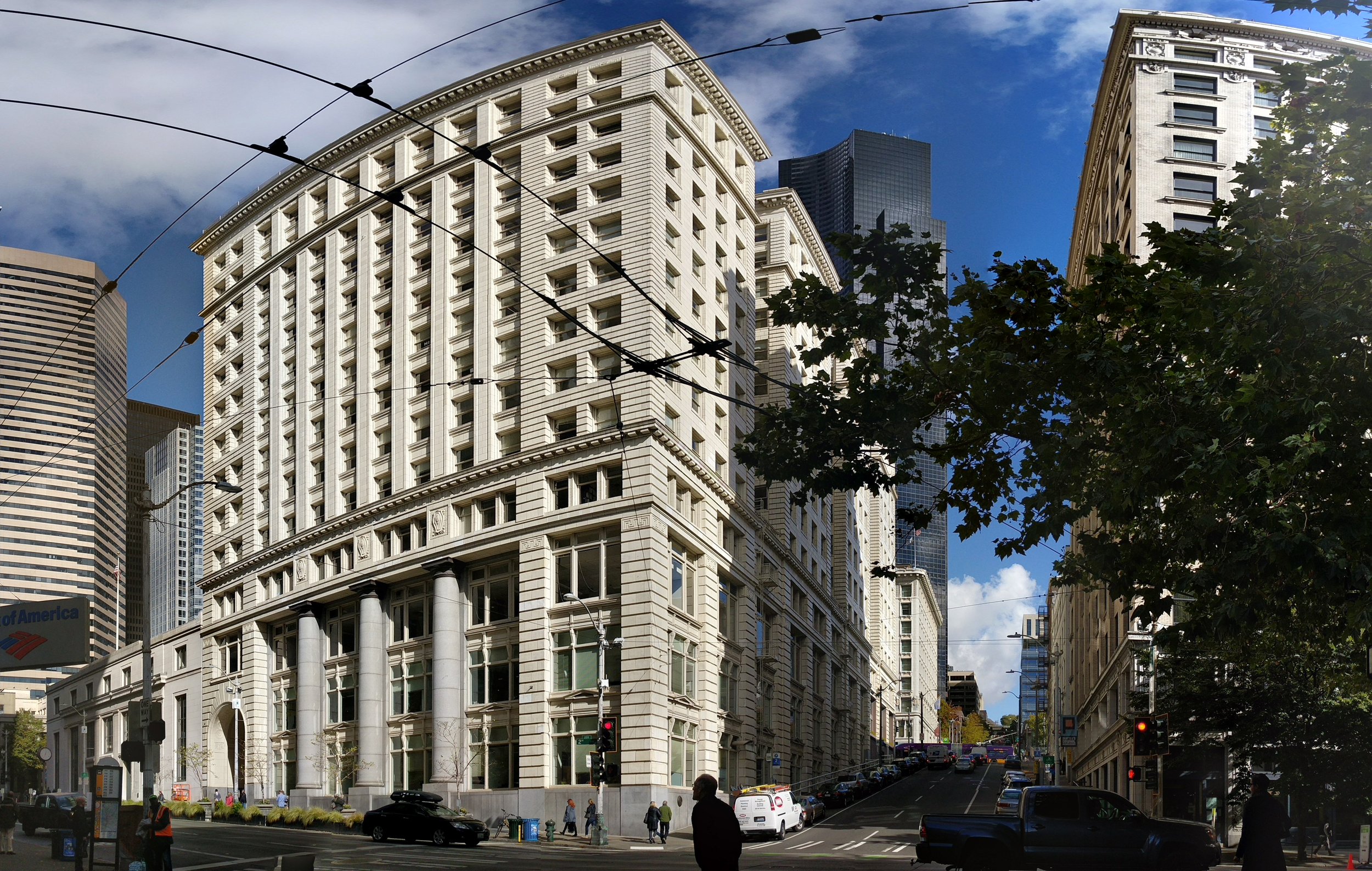
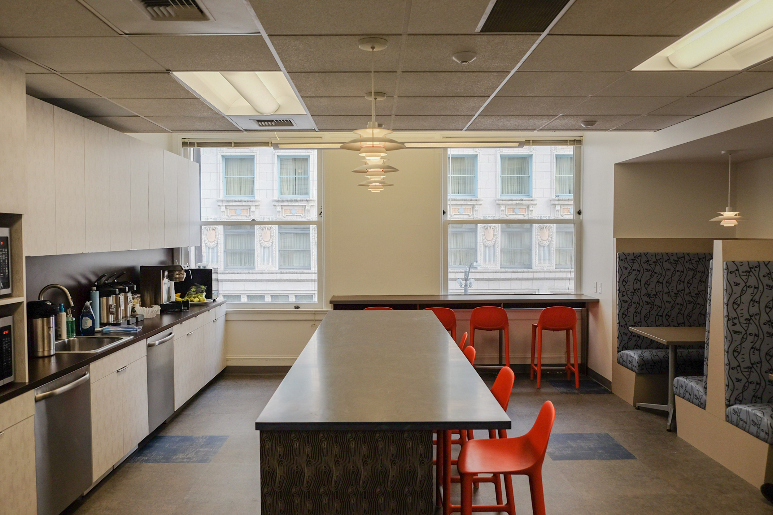
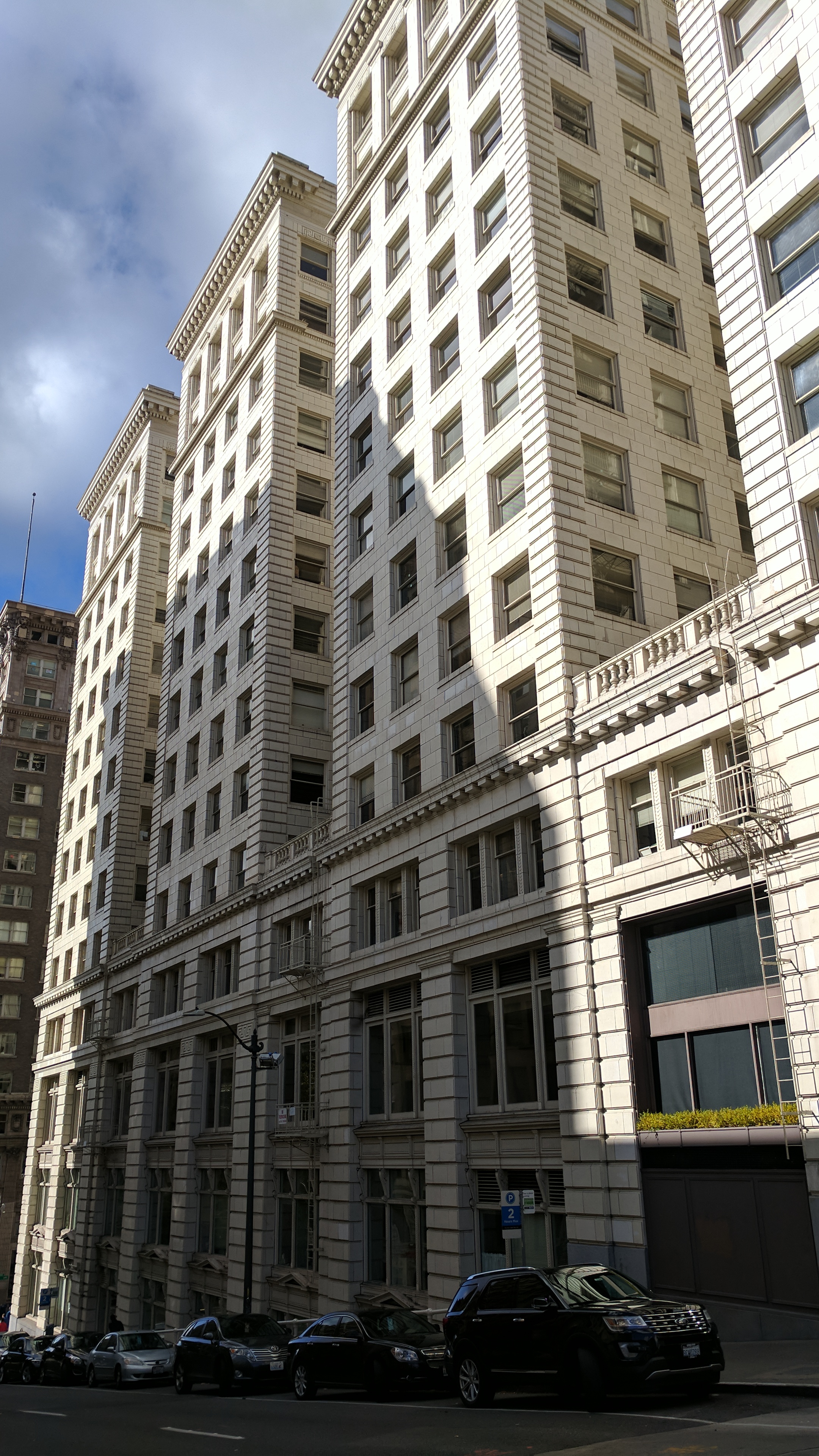
New Seattle Address. Same Focus on Earth Science and Engineering.
As we near 20 years in business, Aspect has moved its Seattle office to a new address and bigger space in Seattle’s iconic Dexter Horton building. Our expanding client base and growing staff—now over 100 strong across seven offices in Washington and Oregon—is driving the move.
“The Pacific Northwest is thriving and so is the demand for our earth and water services,” says Tim Flynn, Aspect’s President. “This move represents the culmination of almost two decades of upward growth driven by clients in the Seattle market and throughout the Pacific Northwest.”
The Dexter Horton building—located in the heart of Seattle—has a combination of grand architectural aesthetic with innovative modern features. The 1926 building is a historical landmark as well as LEED Gold-certified. Aspect’s office on the 5th floor was designed intentionally to provide clients and staff with a variety of ways to collaborate, including open layout areas and comfortable meeting spaces.
Come visit us at 710 Second Ave, Suite 550, Seattle, WA 98104!

Meet Ingrid Ekstrom and David Unruh!
Project Hydrogeologist Ingrid Ekstrom and Staff Scientist David Unruh recently joined Aspect — Ingrid in our Yakima office and David in our Seattle office. Here are five questions we asked to get to know them better.

Ingrid Ekstrom, Project Hydrogeologist
Where are you from? If you’re not from the Pacific Northwest, what brought you here?
I am originally from Memphis, Tennessee, but have lived in Ellensburg for the past 13 or so years. I spent a couple years in Wisconsin before moving to Washington with my husband, and we have really enjoyed living in central Washington ever since.What inspired you to pursue water resources? What made you curious about it?
My background is first in geology. After college, I worked with the US Geological Survey on a couple projects assisting with landslide hazard mapping in Nicaragua and river recognizance work in the southern US looking for liquefaction features from past earthquakes in the area. Both projects had water components that I found very interesting, and I decided to study hydrogeology in graduate school. I was really drawn to the practical side of the field. Moving to the western US in an arid area made me interested in water supply and water rights management. Then, working at the Washington State Department of Ecology and later at the Department of Natural Resources, I had a chance to learn and work with water rights and was enjoyed being able to rely on my hydrogeology background for a variety of projects.
What do you like best about your area of expertise? What excites you and keeps you motivated?
I enjoy water resources and hydrogeology because there are always unique challenges to figure out and problems to solve that allow me to constantly learn. I also appreciate that water resources involves a variety of disciplines that keep changing over time. Past experiences working with water rights have given me a chance to see things from different perspectives, and I really enjoy working with and learning from other people active in or reliant on the field.
What do you like to do when you aren’t working?
When I’m not working, I love spending time with my family. I like traveling, hiking, going to the park with my kids, or just relaxing in the backyard. We started a small garden and are working on expanding it this next year. The kids’ activities keep me busy. And, as they have gotten old enough to stand upright on skis, we are all learning cross-country skiing (and falling) together, and we are excited for the snow this year. We live a distance away from family and enjoy traveling for visits to the Midwest and Argentina.
Where in the world would you like to travel next?
I would like to take a family car trip camping and traveling through National Parks in the western US. I would also love to go to southern Argentina to visit the glaciers and then travel back to Costa Rica and check out the animals and volcanos with the kids. In the near and more practical future, I would like to visit the north Cascades and northeastern Washington.

David Unruh, Staff Scientist
Where are you from? If you’re not from the Pacific Northwest, what brought you here?
I grew up in Kansas City, Kansas, and moved to the mountains in Flagstaff, Arizona, as soon as I finished high school. I moved to Pullman, Washington, in 2016 to complete my MS at Washington State. While in Pullman, I made frequent trips to Seattle to visit my sister, and quickly resolved to move as soon as I finished my degree. I really enjoy spending time in the mountains as well as having easy access to music and art, and Seattle has all that in spades.
What inspired you to pursue geology? What made you curious about it?
Geology was a bit of a shot in the dark for me. I had a great environmental science teacher in high school who got me started on the natural sciences, but I really was just guessing when I enrolled in the geology program at Northern Arizona University. I knew I wanted to do something in the sciences that would allow me to be outside a lot, and geology seemed like a great discipline for me. My guess turned out to be astute, and I have continued to pursue my interest in geology and environmental science ever since!
What do you like best about your area of expertise? What excites you and keeps you motivated?
The thing I enjoy most about geology is the ability to infer large-scale processes from basic data points, like interpreting complex folding and faulting relationships at depth exclusively from surface strike and dip data. It’s really interesting to me to be able to apply these principles to the interactions people have with the earth.
What do you like to do when you aren’t working?
I’m a big outdoors person, so I try to get out to the mountains as frequently as possible. My sport of choice is mountain biking, but I’ve been doing more rock climbing and backpacking since moving to Seattle. When I’m not outside, I like to fix bikes and find good concerts to attend.
Where in the world would you like to travel next?
I took a trip to Seoul, South Korea, in the summer of 2017 that made me really interested in visiting more of Asia. I hope to make it out to Osaka, Japan, or do a road trip on mopeds through Vietnam sometime soon.